

Chapter Two
The Land
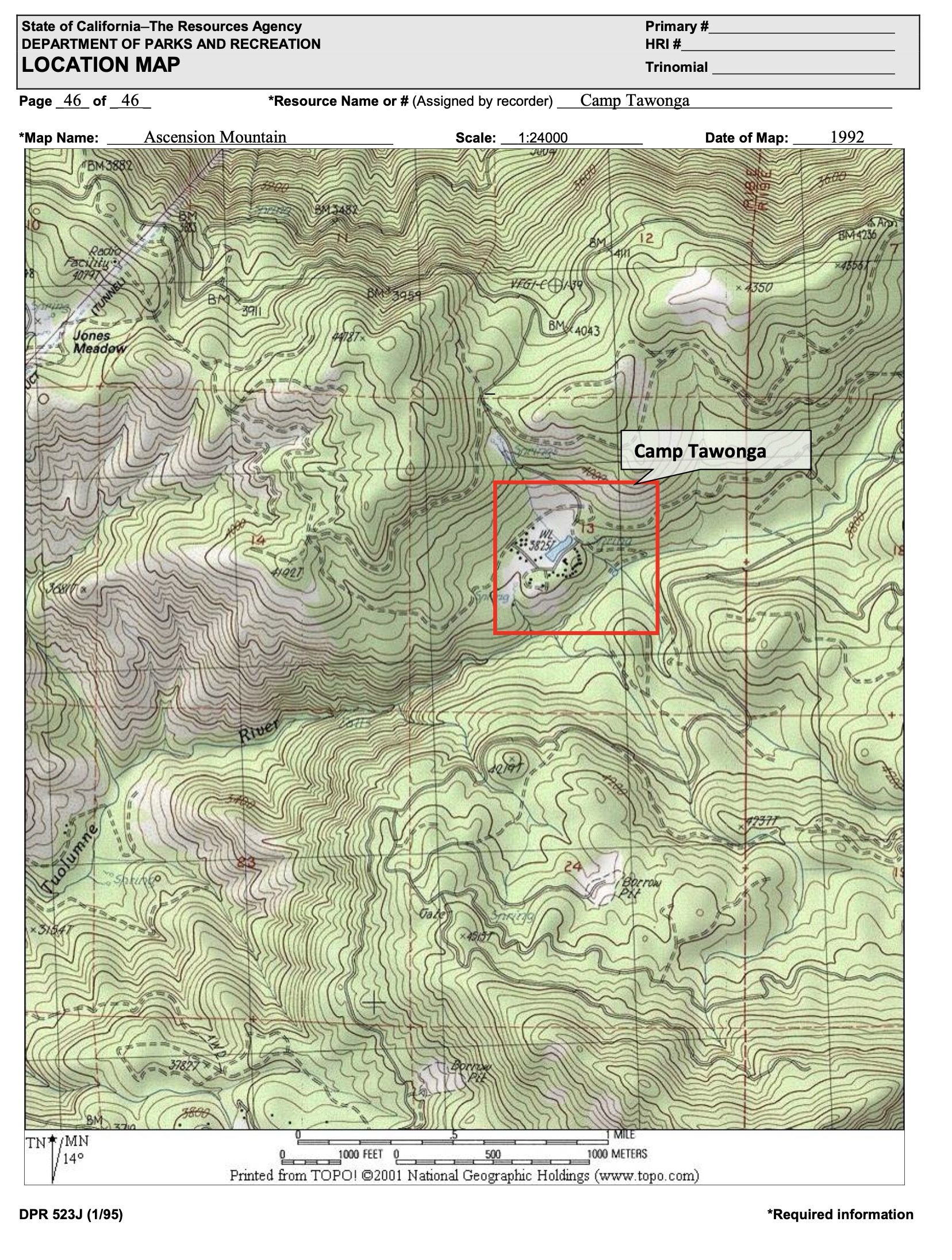
Tawonga’s 160 Acres
in the Stanislaus National Forest


Having traced Camp Tawonga’s early history in Chapter One of this visual history, we now turn to the land —160 acres along the Middle Fork of the Tuolumne River — that Tawonga calls home.
After years of staffing shortages had forced Camp Tawonga to close during World War II, the camp remained dormant for more than two decades.
In 1964, Robert Sinton led the United Jewish Community Center (UJCC) of the Bay Area in the search for a new site to re-open it.

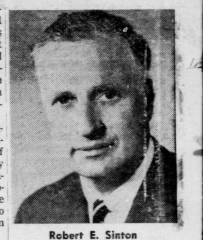
Robert Sinton, pictured in the Jewish Community Bulletin, 1964
Robert Sinton, pictured in the Jewish Community Bulletin, 1964
Sinton’s search led him to an area of the Stanislaus National Forest, where the UJCC was able to purchase the 160-acre property of an existing camp owned and operated by the Columbia Park Boys’ Club of San Francisco.

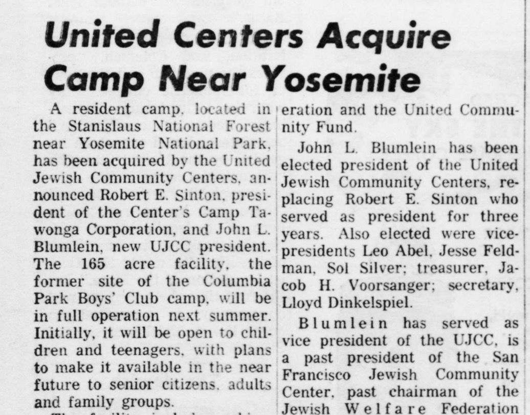
Headline in the Jewish Community Bulletin, May 22, 1964
Headline in the Jewish Community Bulletin, May 22, 1964
The Columbia Park Boys’ Club was founded in 1895 in San Francisco with the intention of providing outdoor experiences for working-class boys from the city. The club was not a Jewish organization.

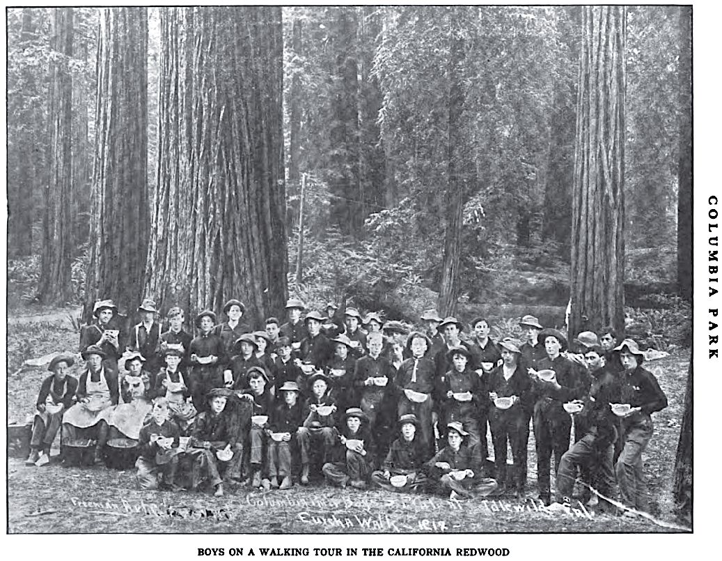
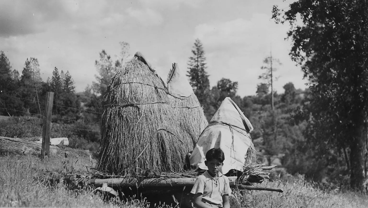
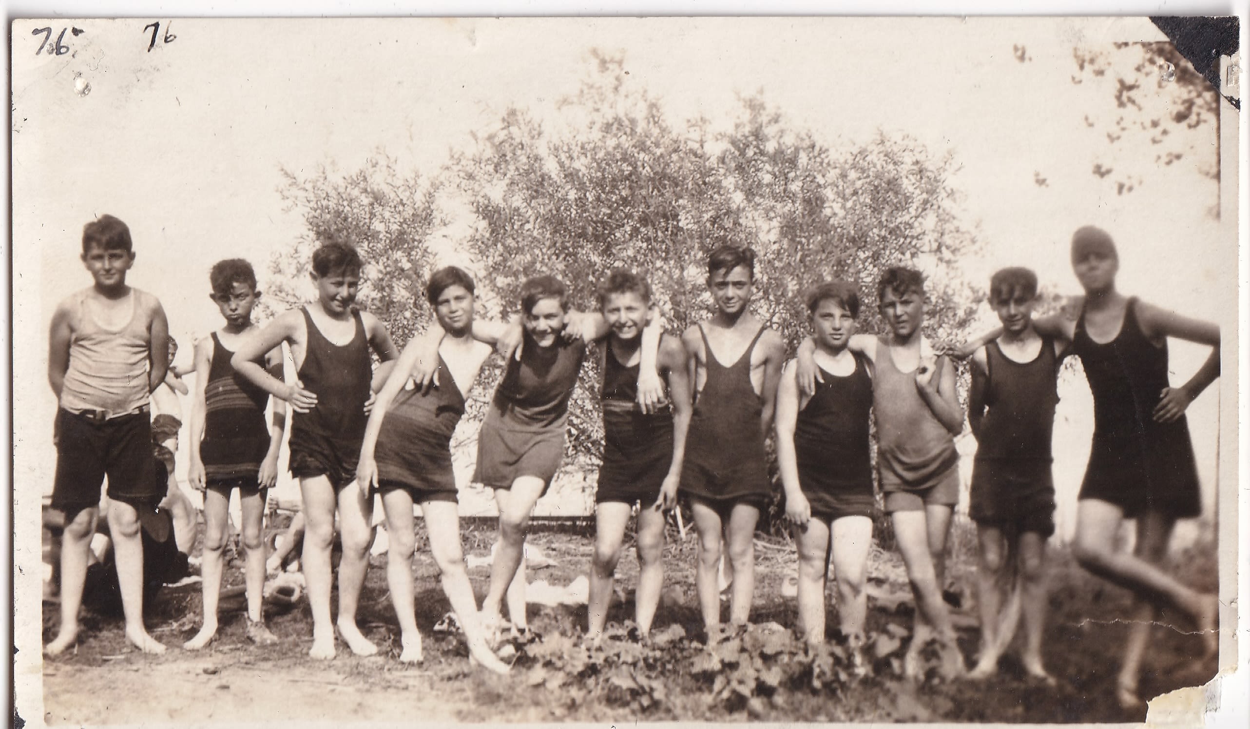
A group photo of Columbia Park Boys’ Club members, dated 1917
A group photo of Columbia Park Boys’ Club members, dated 1917
The Property
The property Tawonga purchased was located in the Stanislaus National Forest, between the town of Groveland and the entrance to Yosemite National Park.
This region of California had developed into a popular location for a variety of summer camps. In the first half of the 20th century, several Bay Area cities (including Oakland, Berkeley, and San Francisco) and the University of California had founded summer camps in the area to provide urban dwellers with a cheap and healthy getaway.

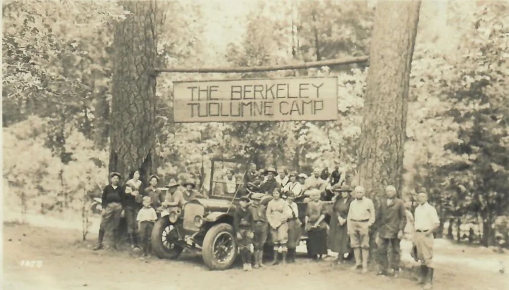
The Berkeley Tuolumne Camp was one of several city-owned camps established in the first half of the 20th century in the Sierra Nevada in the region near Yosemite National Park.
The Berkeley Tuolumne Camp was one of several city-owned camps established in the first half of the 20th century in the Sierra Nevada in the region near Yosemite National Park.

Why a Square?
Camp Tawonga’s boundaries — a neat 160-acre square set amid winding rivers and steep terrain — might appear somewhat surprising. The square shape does not reflect the land’s natural contours. Instead, it reflects the way the United States divided and claimed western lands in the 19th century.
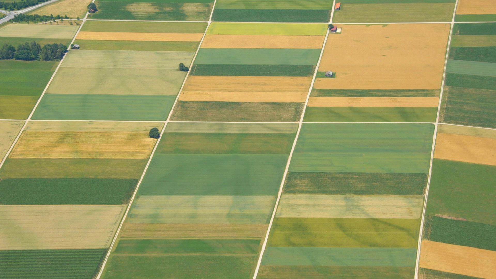
Beginning in the late 1700s, the federal government used a system called the Public Land Survey System to map the country. Surveyors laid an abstract grid over the landscape, dividing land into townships and sections, regardless of mountains, rivers, or valleys.

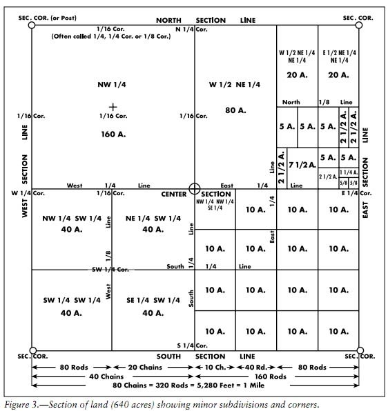
It’s the same grid many Americans have seen from an airplane window: long, straight lines forming a patchwork of rectangles across the land, especially visible over the agricultural Midwest and Central Valley.

Under laws like the Homestead Act of 1862, individuals and companies could claim parcels — often 160 acres, or one quarter of a square mile — by occupying or developing them.
Of course, almost all of the land that settlers and companies claimed had been previously occupied by Native people, including the parcel of land that Tawonga eventually purchased in the 1960s. The Central Sierra Miwok people had occupied that particular parcel of land for thousands of years. (See below for more detail.)


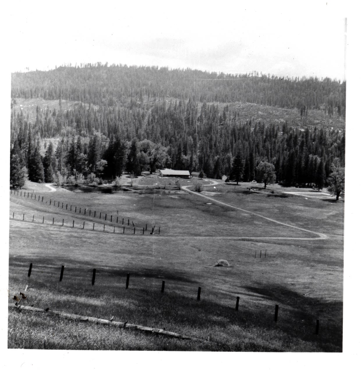

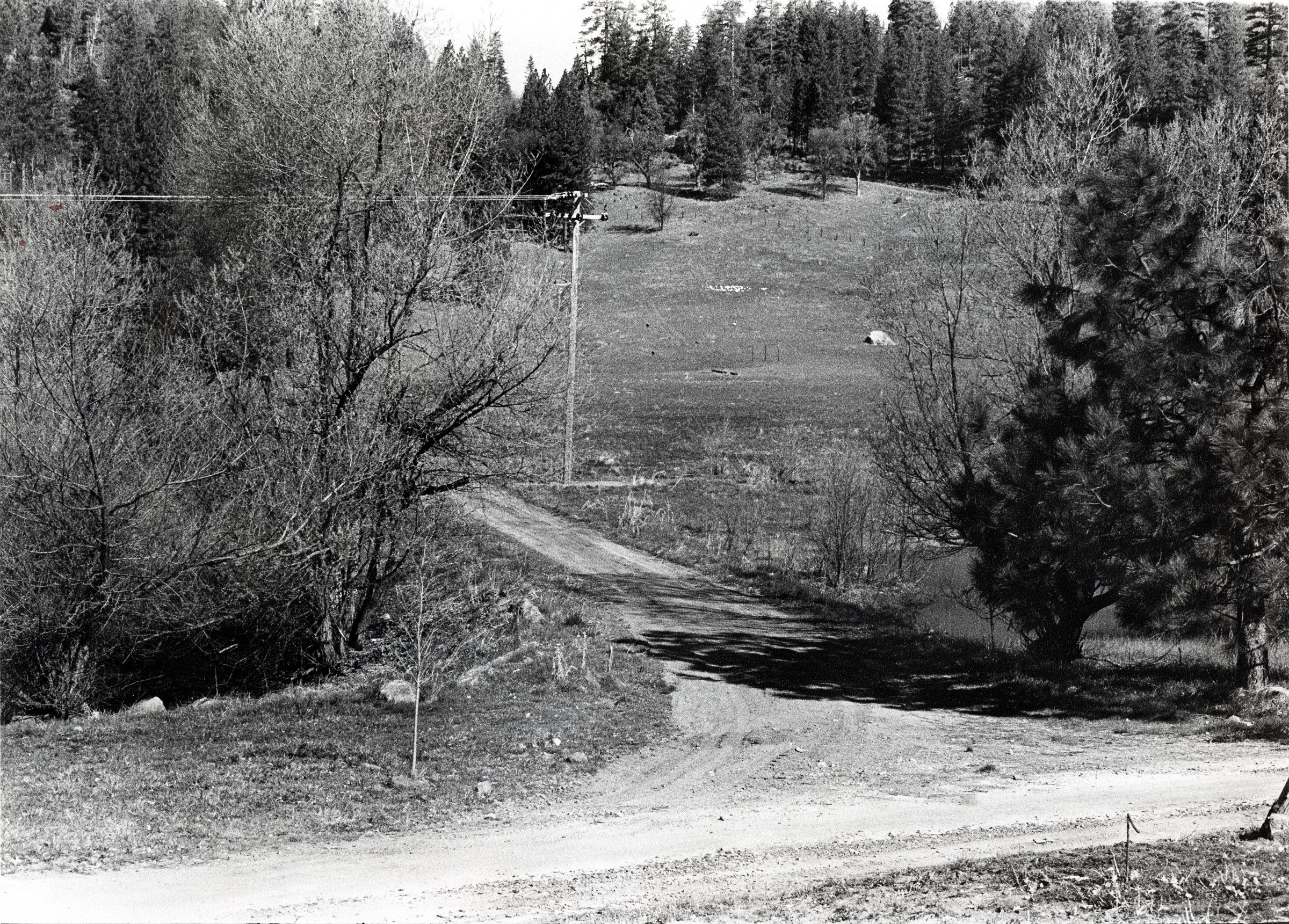

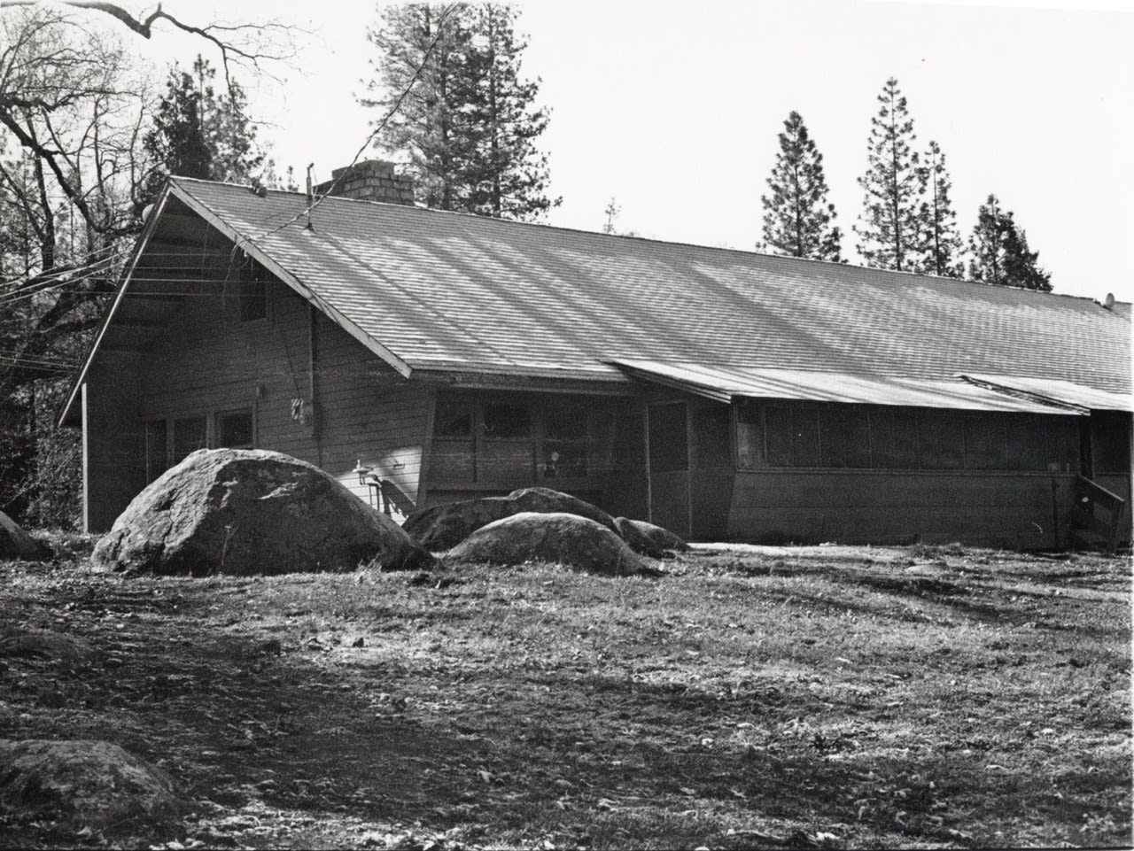
Here are a few photos that show the Tuolumne property around the time that Tawonga purchased it in 1964.
The photos are undated and their origins are uncertain, but our best guess is that they were used to show UJCC leaders in San Francisco what the land looked like as they considered buying the property.
This is the original Dining Hall, built by the Columbia Park Boys’ Club. This structure was replaced by our current Dining Hall in 1990.
This is a map of the Columbia Boys’ Park Camp a few years before Tawonga purchased the property.
This map portrays a master plan for the Columbia Park Boys’ Camp, not necessarily the conditions on the ground. It's quite likely that many of the buildings shown here were never constructed.
Let's take a closer look . . .
The Dining Hall and its surrounding buildings formed the central hub of camp, just as they do today at Tawonga.
The building marked “Administration” on this map served as both Dining Hall and Office.

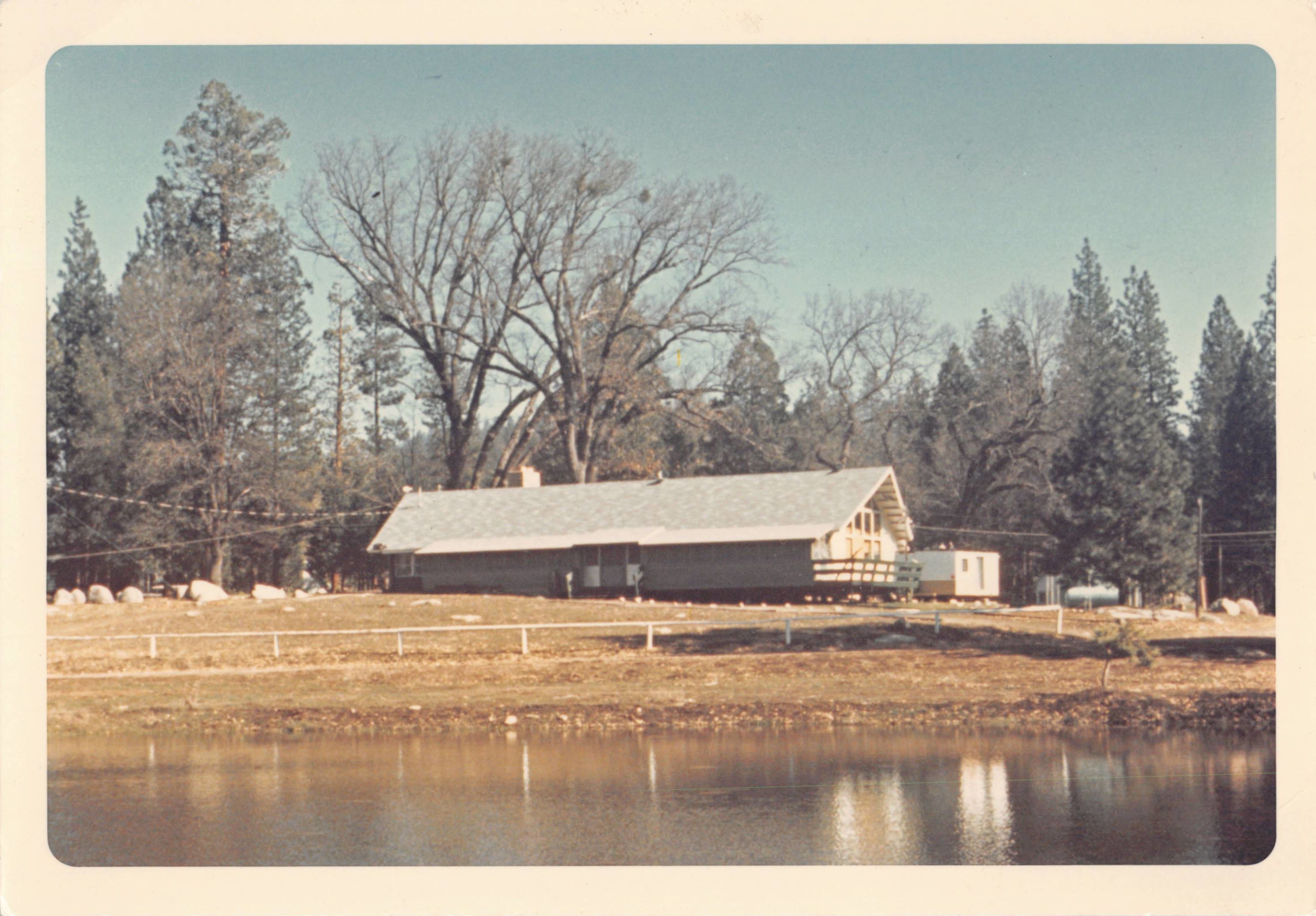
A view of the old Dining Hall, most likely taken in the late 1960s
A view of the old Dining Hall, most likely taken in the late 1960s
This area, that we now call Pipeline, shows a bridge over the river (in the same location where our seasonal bridge is today) as well as a dam and a pump.
By the time Tawonga purchased the land in 1965, the dam was no longer in use; only its remaining structures were still visible along the river, as they are today.

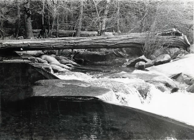
Remains of the dam near Pipeline, ca. 1965
Remains of the dam near Pipeline, ca. 1965
If you’ve ever wondered why the area around today’s Moadone (the gazebo near the Ga-ga pit and Garden) is so swampy at certain times of year, it’s because there used to be a pond in that same spot.
This area of cabins for older boys (marked “Seniors”) occupies roughly the same spot that the Arts & Crafts building does today.
This is an undated aerial view of the property. Based on the visual evidence, it appears to be from the early 1960s, probably a few years before Camp Tawonga purchased the property.
You can see there were originally two ponds, later combined into the body of water we now call the lake. (The lines on the map are topographical marks indicating elevation.)
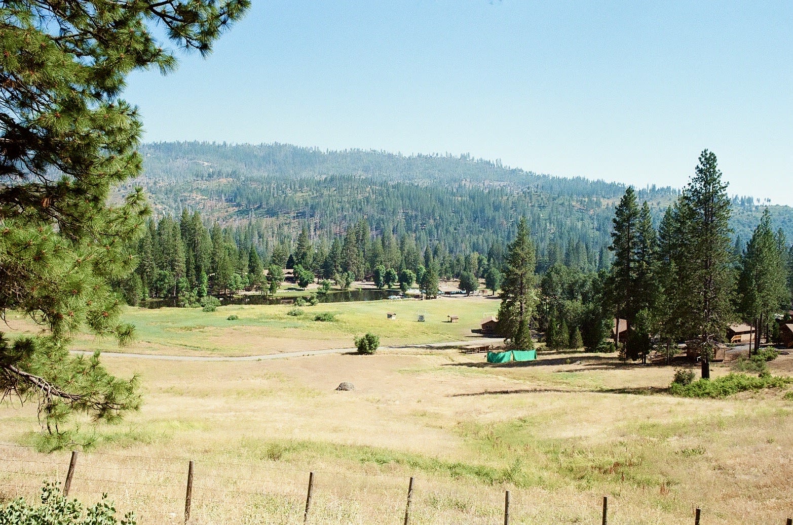
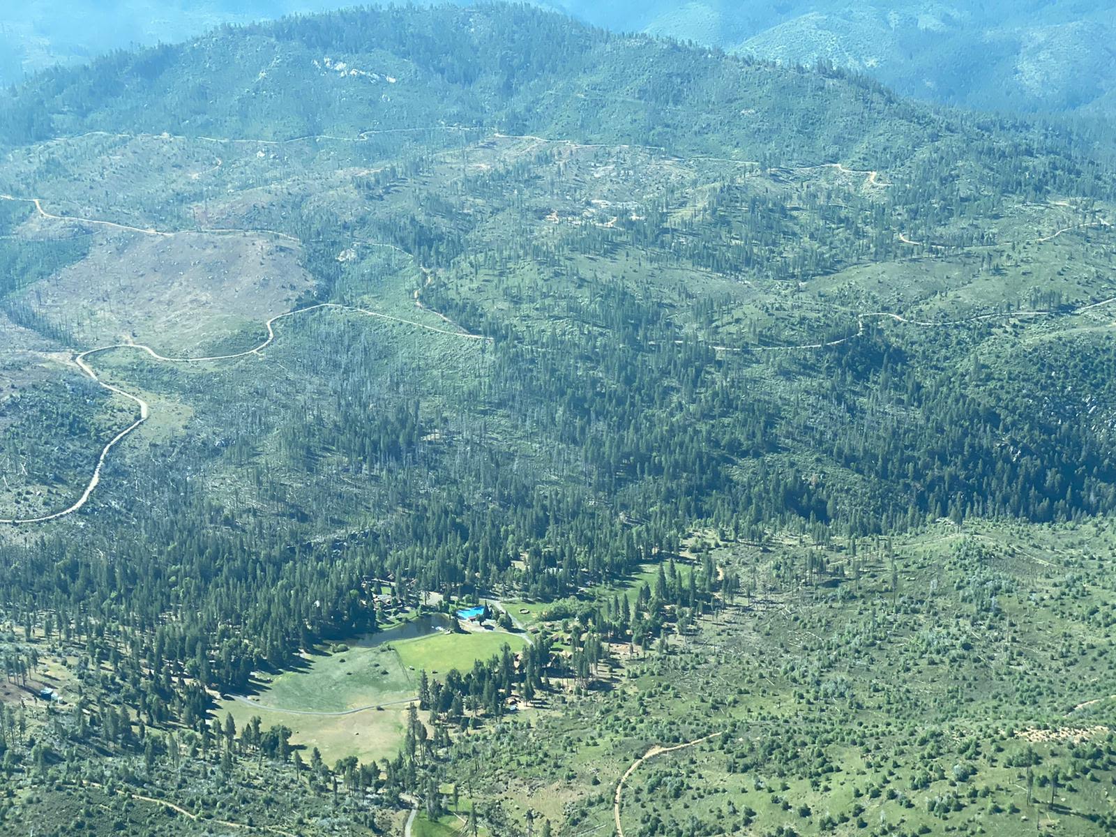
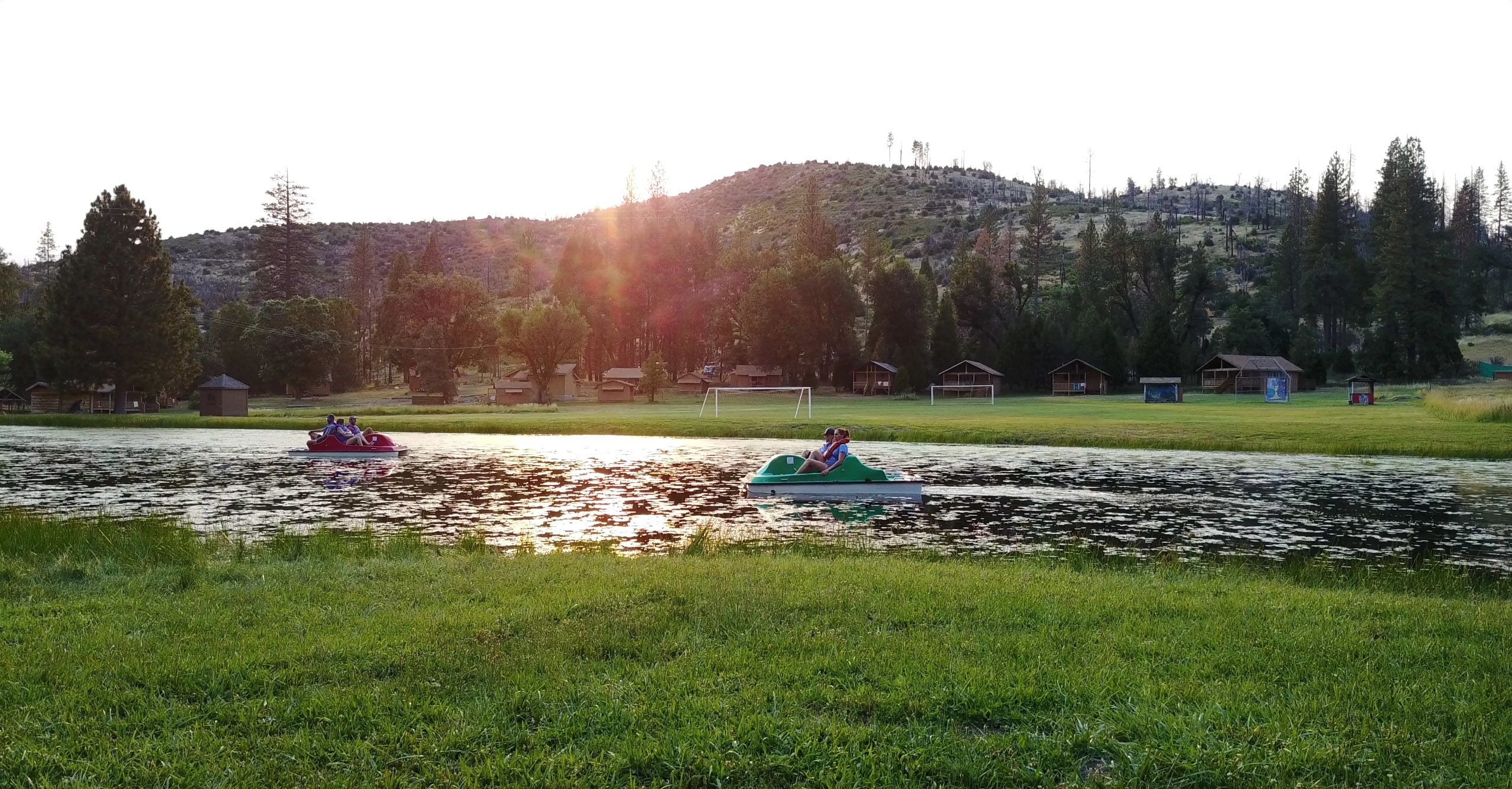
The lake, used for recreation, is not a natural body of water; it’s filled with water pumped up from the Tuolumne River. But it’s not just intended for paddle boats and Getting Gnarly. It also serves as a source of water for irrigation and as an emergency reservoir for firefighting.

Notice that when this photo was taken, the space for the swimming pool had been cleared, but the pool had yet to be completed.
Stepping Back: A Deeper History of the Land
It’s easy to think of Tawonga’s story as beginning in the 1960s, when the camp first took root here. But the land itself holds a longer memory. Long before maps, cabins, or aerial photographs, this place was shaped by ice, water, and Native people —specifically the Central Sierra Miwok people — whose lives unfolded here for thousands of years. To see the land clearly, we have to rewind the story.
The Sierra Range
Before cabins and campfires dotted the landscape, this land was already ancient.
For millions of years, the mountains of the Sierra Nevada have been rising — pushed up by slow movements of the Earth’s crust and sculpted by ice and water.
Glaciers once poured down these slopes, grinding granite into the smooth domes and steep canyons that define the high country today.

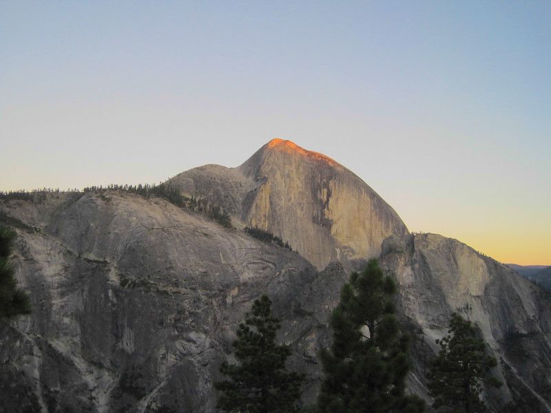
A view of Half Dome in Yosemite National Park
A view of Half Dome in Yosemite National Park

Native Inhabitants
For thousands of years, this region was home to the Miwok people, whose territory stretched across the western slopes of the Sierra Nevada. They lived in small bands connected through larger village networks, moving seasonally between the foothills and higher elevations to hunt, gather, and trade. Miwok knowledge of the land – passed down through oral traditions, lived experience, and cultural practice – reflects a deep and sustained relationship with this landscape that continues through descendant communities today.
Although Indigenous communities were forcibly displaced from much of their ancestral land, Miwok people did not disappear from this region. Miwok communities continue to live in and around the Central Sierra, maintaining cultural traditions, stewarding the land, and sharing knowledge passed down across generations. At Tawonga, this living presence is reflected not only in the land itself, but also in the relationships Camp has built with local Miwok educators, who help connect campers and staff to the history and meaning of this place today.
In the absence of comprehensive written records, the land itself remains an essential source of evidence. Physical traces embedded in the landscape help illuminate how Miwok people lived and worked here – offering a different kind of historical record, one grounded in place.

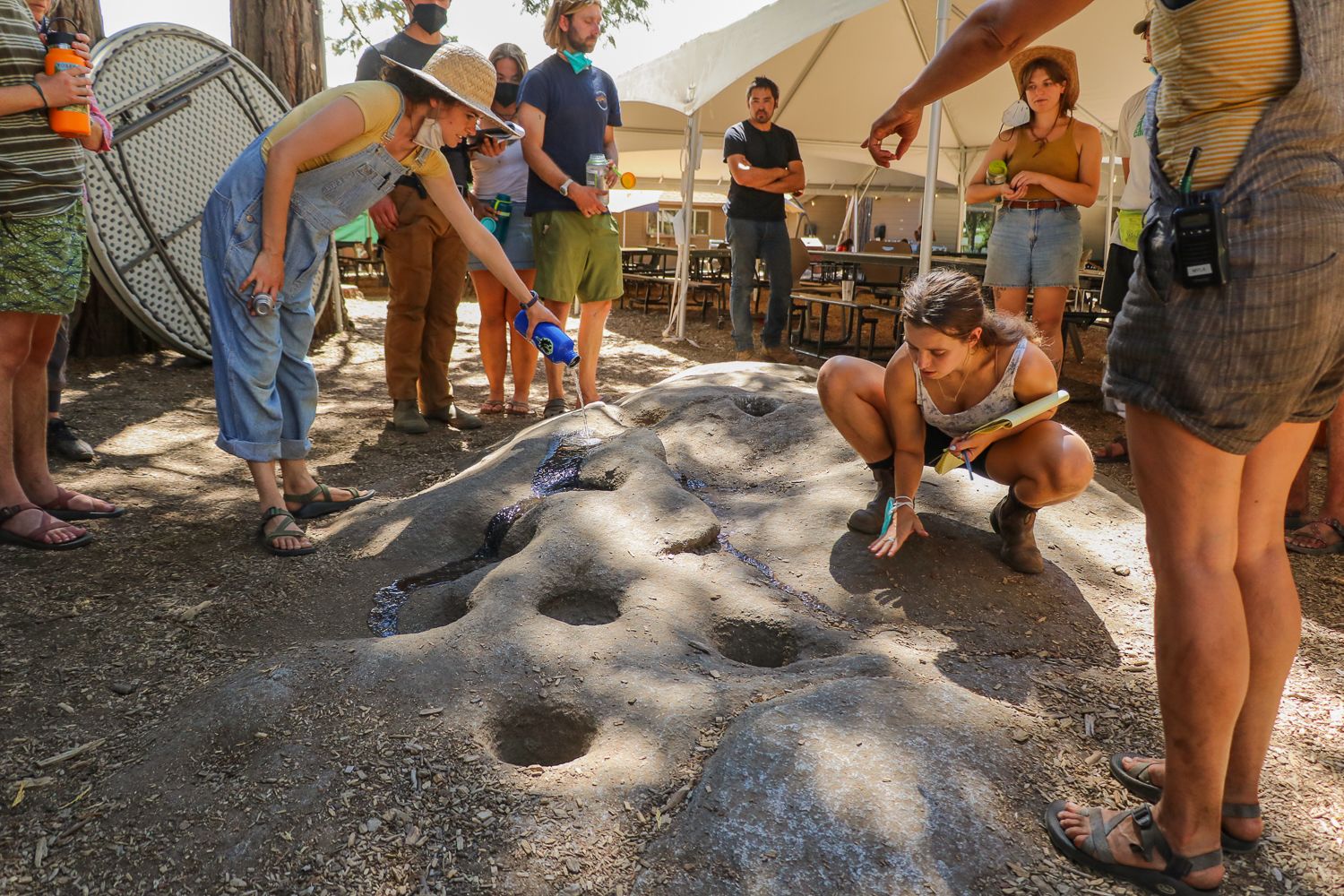
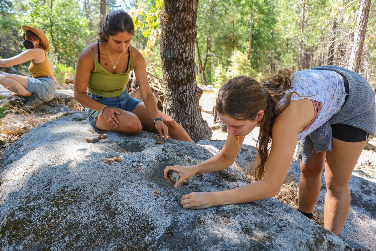
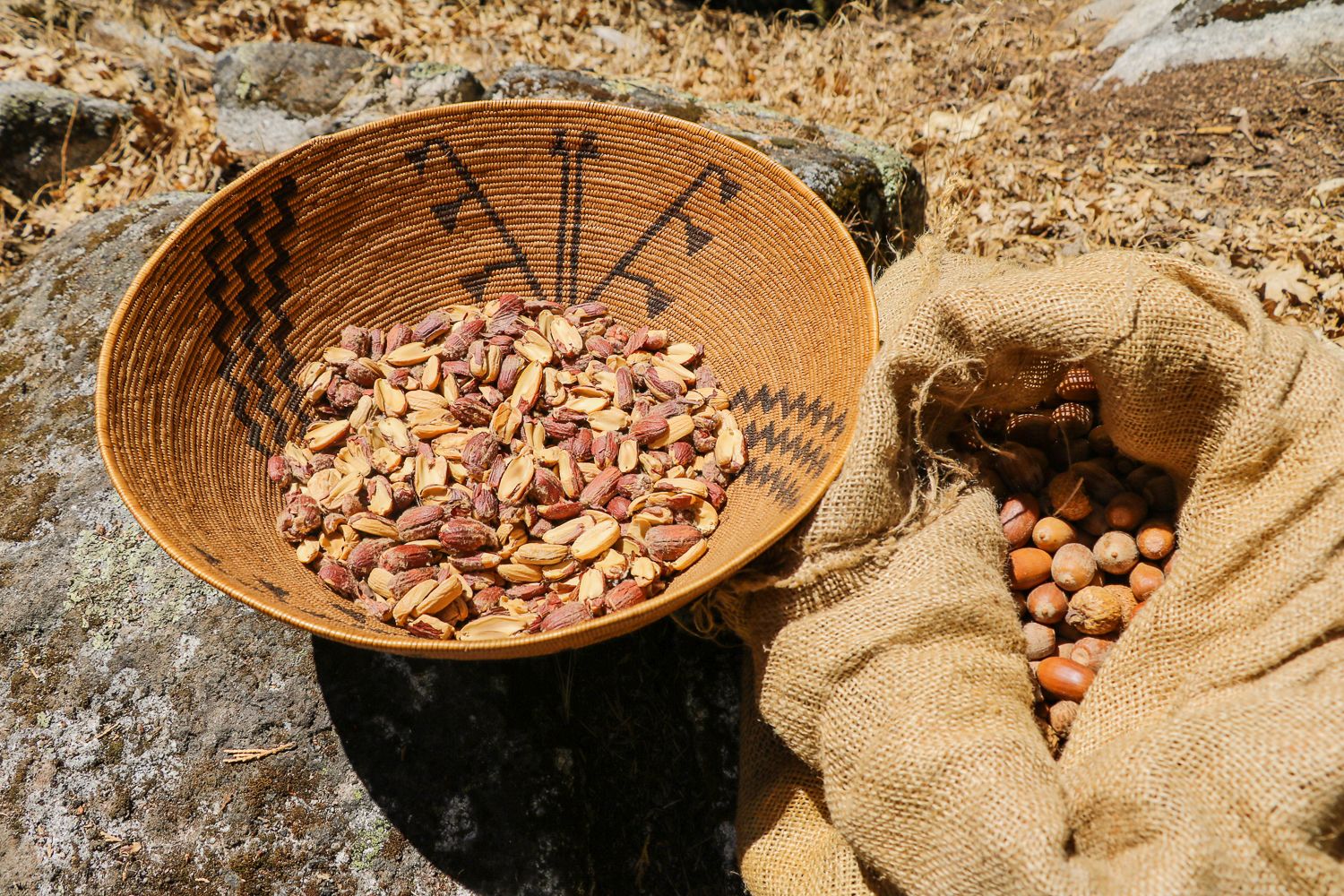
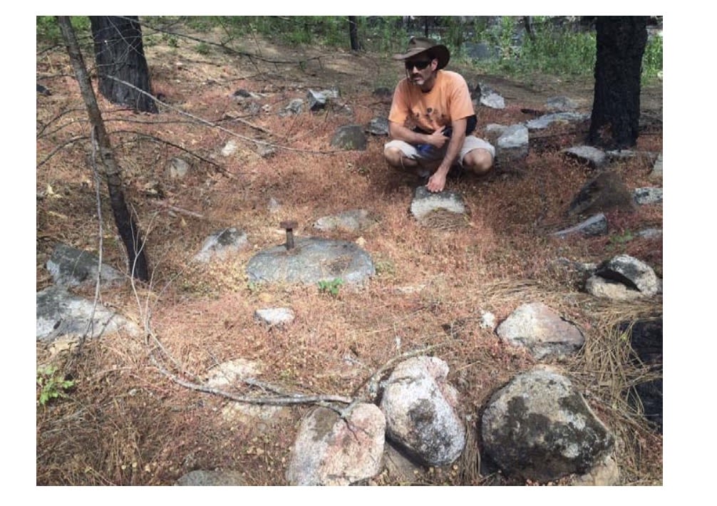
One of those material traces that still exists on Tawonga’s property is the presence of what Miwok educator's call pounding rocks or grinding rocks (which archaeologists call bedrock mortars). These shallow, cup-shaped depressions were ground into granite boulders over generations as Miwok families pounded acorns into meal.

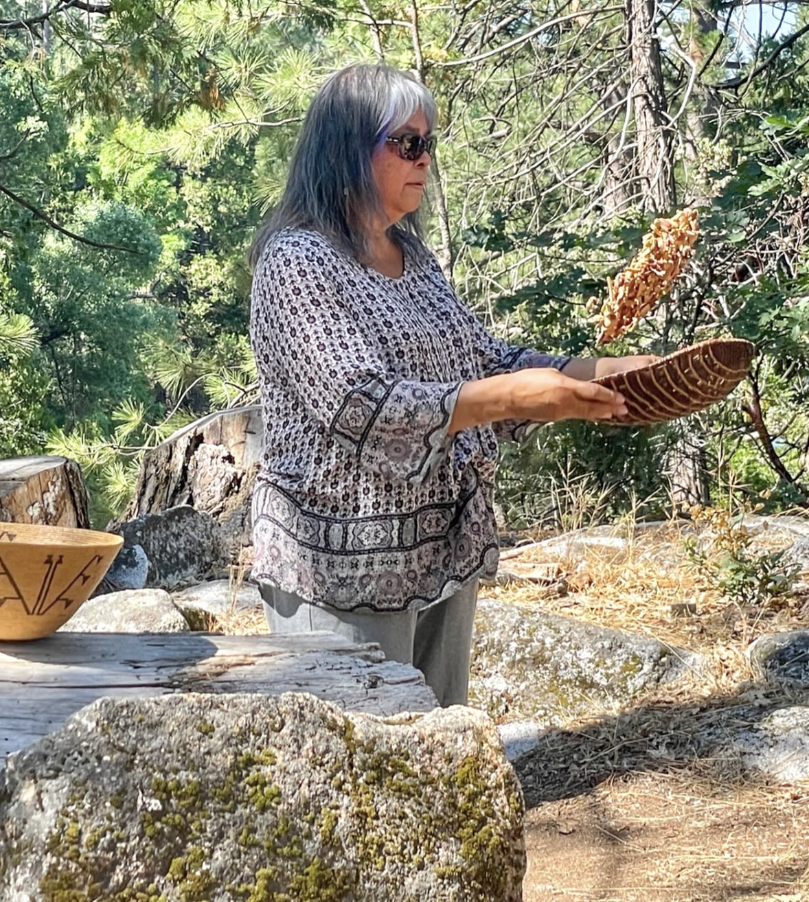
Jennifer Bates, a California Native Consultant and Mewuk basket weaver, demonstrates a method for winnowing acorns at Camp Tawonga in 2023.
Jennifer Bates, a California Native Consultant and Mewuk basket weaver, demonstrates a method for winnowing acorns at Camp Tawonga in 2023.
The distribution of pounding rocks throughout Camp shows that medium-sized communities of Miwok people once lived or gathered here, using the surrounding black oaks for food and returning seasonally to process acorns into a staple, nutritious flour.

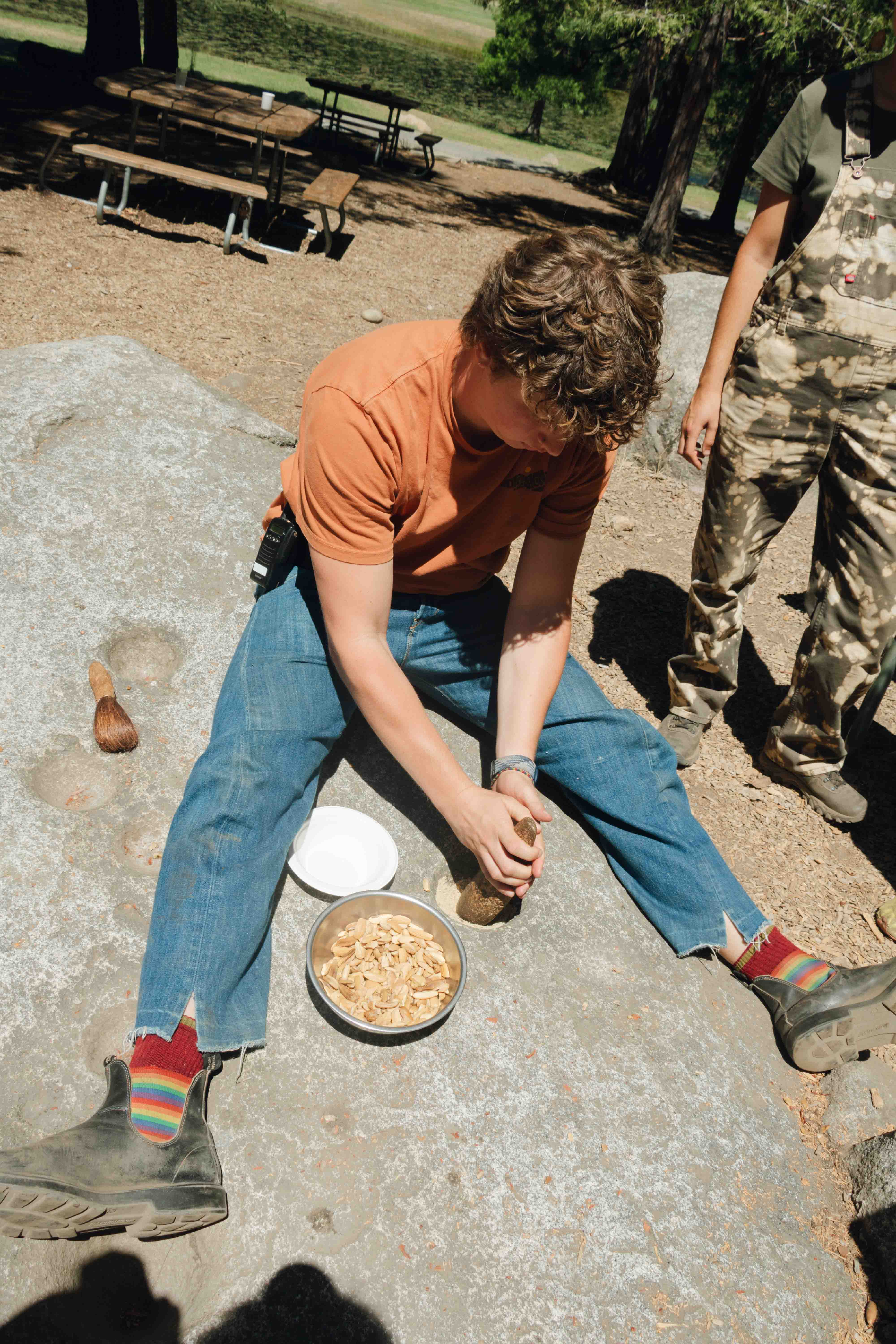
Tawonga director Sam Rubin practices grinding acorns into meal at a pounding rock, 2025.
Tawonga director Sam Rubin practices grinding acorns into meal at a pounding rock, 2025.

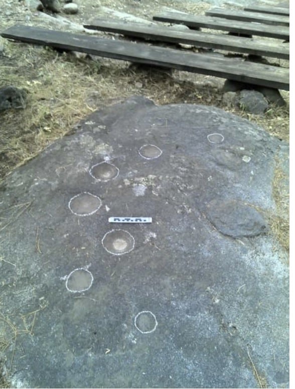


Miwok educators and archaeologists believe that the central area of Camp, near the Dining Hall and stage (the area we now call the Golden Triangle), most likely served as a Miwok gathering place or small village. Its elevated position offers a natural vantage point over the meadows, with easy access to water, shade, and the river below — qualities that have drawn people to this land for thousands of years.
But pounding rocks aren’t found only in the Golden Triangle. They are spread throughout Tawonga’s property. The highest concentration is found in Cookie Corner (the area between the Wilderness building and the parking lot), which, like the Golden Triangle, is a naturally elevated part of the landscape.
Pounding rocks are also found in our outdoor sanctuary Makom Shalom, in multiple spots near the river, and in several other areas throughout Camp.


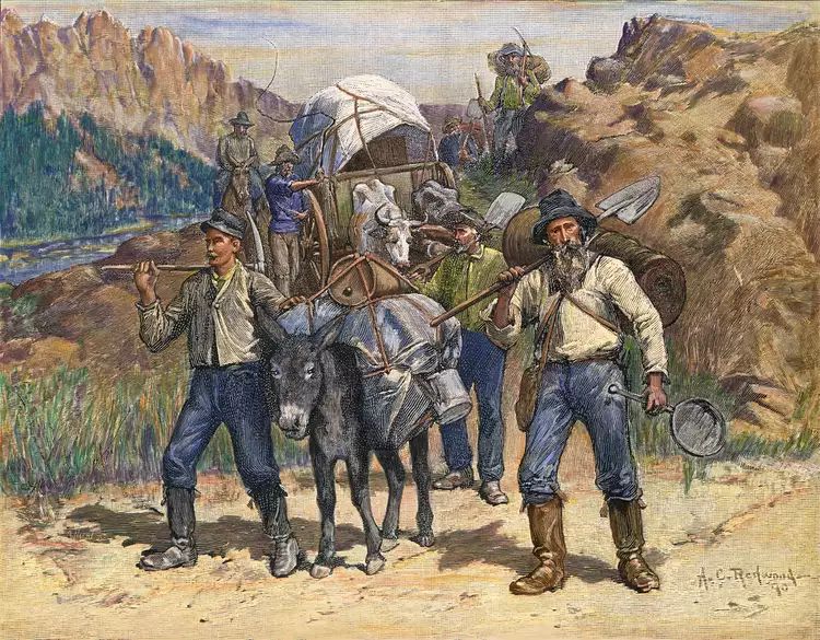


The California Gold Rush
The land that now holds Camp Tawonga was once part of a stable seasonal world, shaped by Miwok families and their deep knowledge of the Sierra. That way of life changed suddenly in the 1850s.
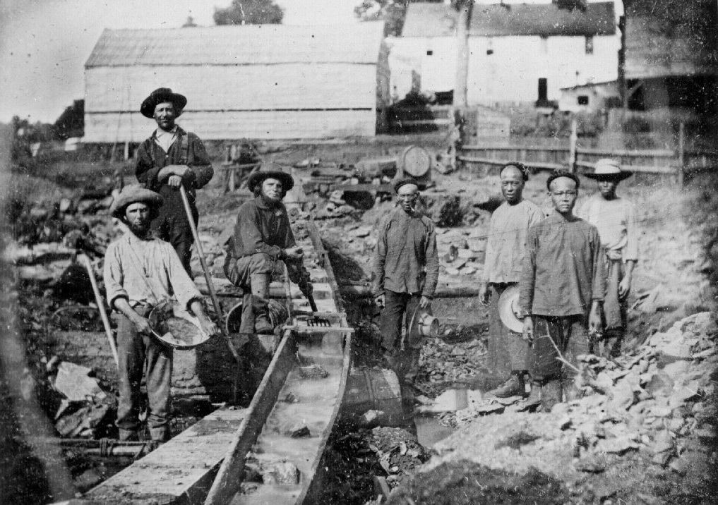
After gold was discovered in the California foothills in 1849, thousands of miners and settlers pushed into the mountains, reshaping the region — and displacing the people who had lived there for generations.

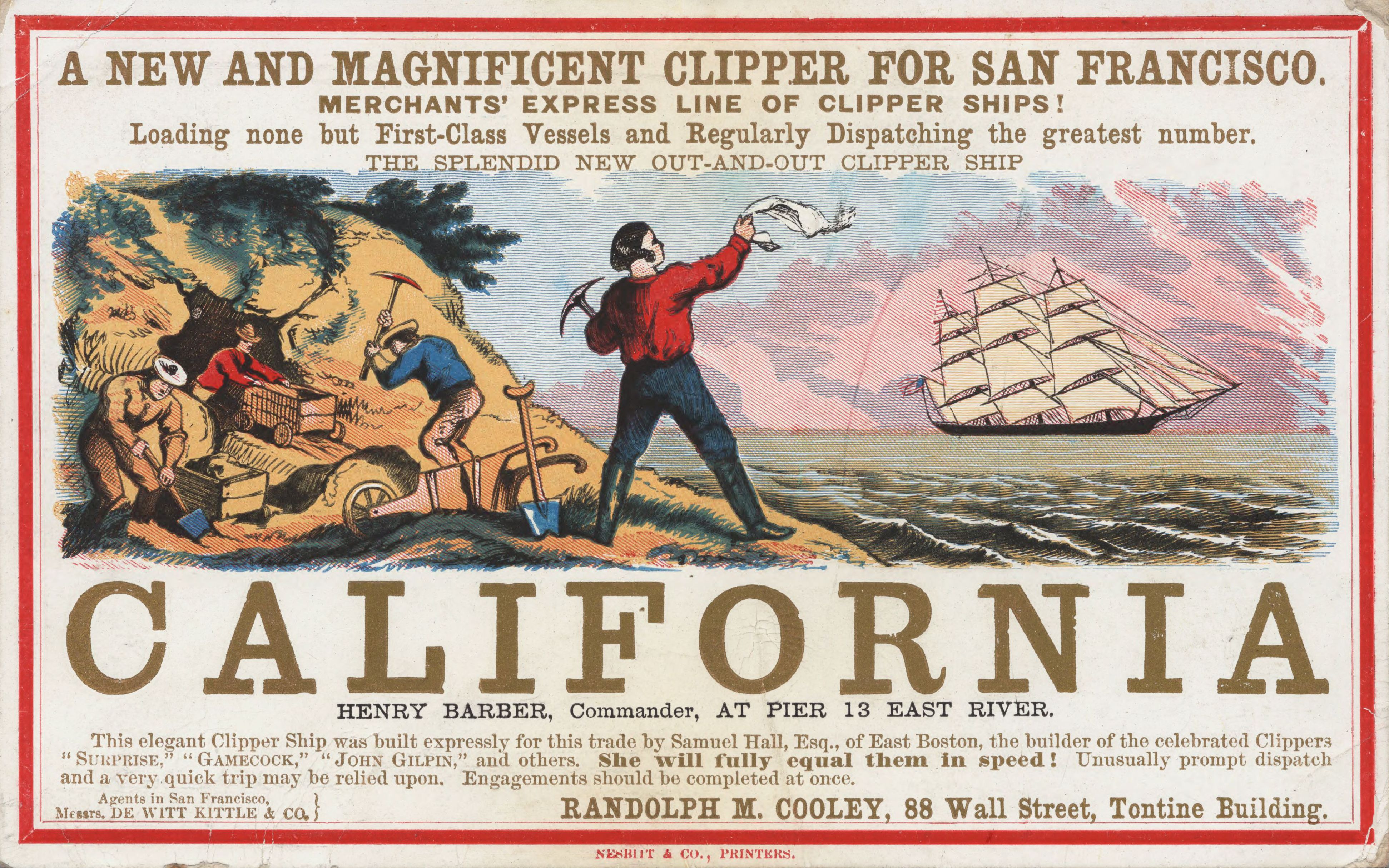
The gold rush brought a tidal wave of newcomers from across the world — miners from the United States, China, Mexico, Chile, even India — all searching for gold in the Sierra foothills.

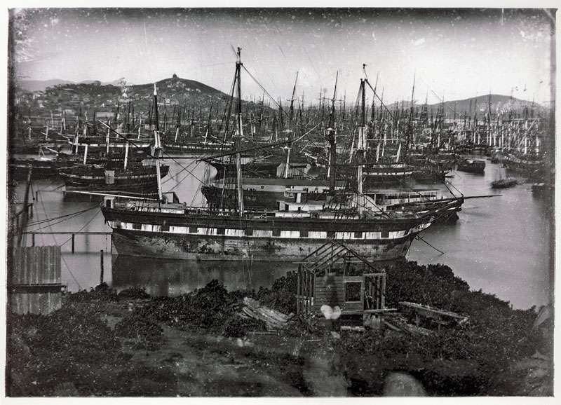
Abandoned ships in the San Francisco Bay in 1849. Many ships were deserted by their crew, who had left immediately after arrival in search of fortune. Hundreds of these ships were later buried under landfill in what is now the Embarcadero. Several old ships are most likely located directly beneath Camp Tawonga’s current headquarters on Steuart Street (which was a wharf in 1849).
Abandoned ships in the San Francisco Bay in 1849. Many ships were deserted by their crew, who had left immediately after arrival in search of fortune. Hundreds of these ships were later buried under landfill in what is now the Embarcadero. Several old ships are most likely located directly beneath Camp Tawonga’s current headquarters on Steuart Street (which was a wharf in 1849).
As settlers and mining companies spread through the foothills and lower slopes of the Western Sierra, they forced Native peoples out from the meadows and river valleys they had inhabited for thousands of years.
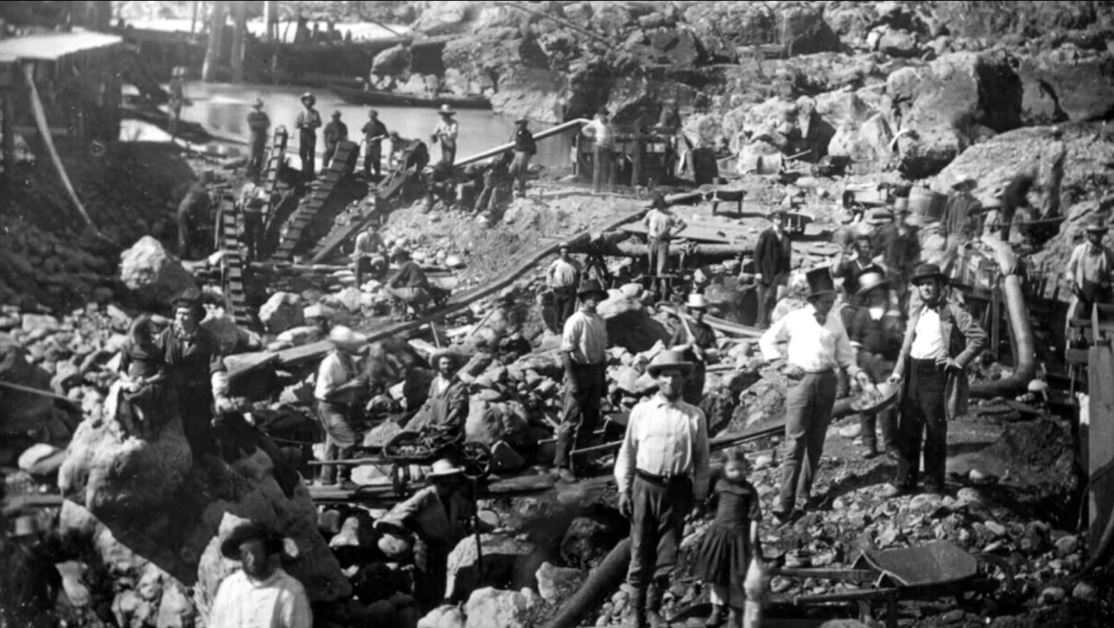
What began as small-scale panning in riverbeds quickly gave way to industrial mining. Rivers were diverted, forests cleared, and hillsides blasted apart by high-pressure water cannons.

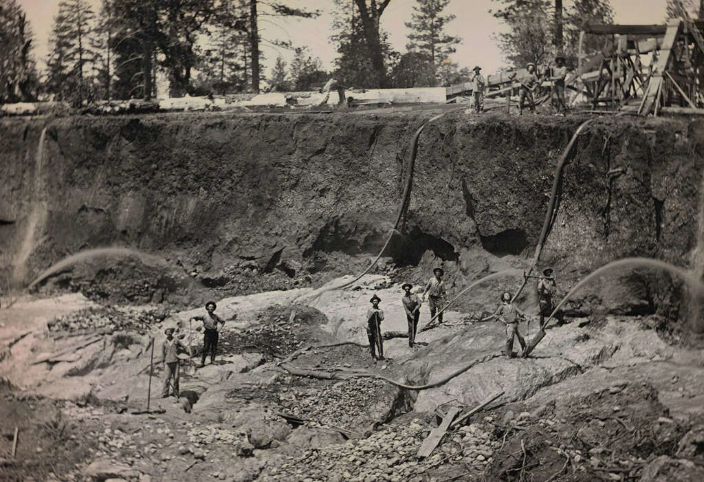
In just a few years, the Sierra landscape which had been shaped slowly by glaciers and rivers was dramatically transformed by human ambition.
Tawonga’s Mining History
This history is still written on Tawonga’s land today. The stretch of the Tuolumne River that runs through Camp was once panned and worked by early miners, and traces remain of more advanced efforts that followed. Though we can’t know the full extent of the mining that took place here, two clear remnants hint at the activity that reshaped this land more than 150 years ago.

The Arrastra
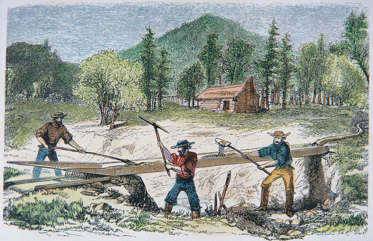
The first — and likely the oldest — evidence of that era is the remains of an arrastra, a primitive ore-crushing mill once common throughout the Sierra. The word comes from the Spanish arrastrar, meaning “to drag.” The device was introduced by Mexican and Chilean miners during the early Gold Rush, adapted from older techniques used in Sonora and other mining regions of northern Mexico.

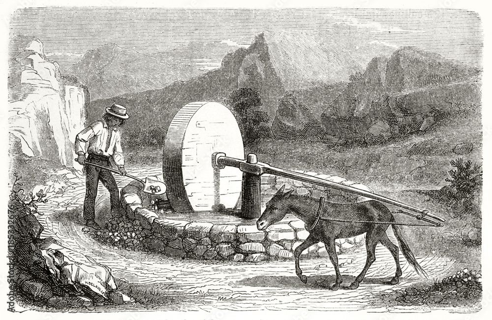
An engraving of a Mexican American miner using an arrastra with a large grinding stone during the California Gold Rush
An engraving of a Mexican American miner using an arrastra with a large grinding stone during the California Gold Rush
An arrastra consisted of a circular stone pit lined with flat rocks. Heavy drag stones, often pulled by a mule or horse, were dragged around the circle to crush ore — usually quartz — into fine gravel from which gold could be extracted with water and mercury.

The logo of the Tuolumne County Historical Society depicts a simpler and more basic version of an arrastra. This is likely the type that was used on the Tawonga property.
The logo of the Tuolumne County Historical Society depicts a simpler and more basic version of an arrastra. This is likely the type that was used on the Tawonga property.
At Tawonga, the remnants of an arrastra lie just above the river, a few yards from what is now known as Ladybug Cove. Its location close to the water suggests that this was part of a small, local operation — miners working by hand and animal power, grinding rock on site before washing out the gold in the nearby river.

The Keystone Ditch
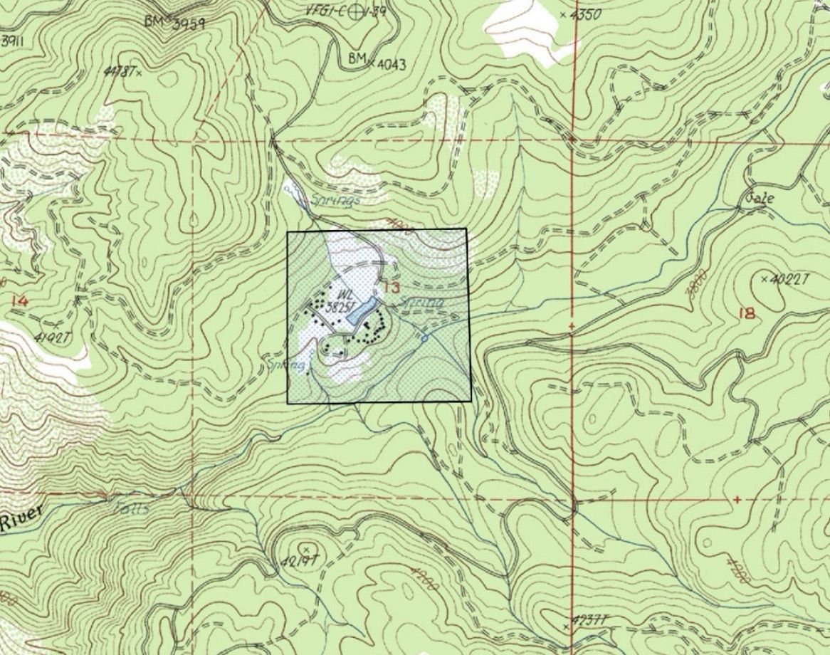
The second remnant of mining activity at Camp Tawonga is known as the Keystone Ditch, which runs through the center of Camp. It’s most recognizable as the shallow ditch that separates the Manzanitas from the Ridge Side road.

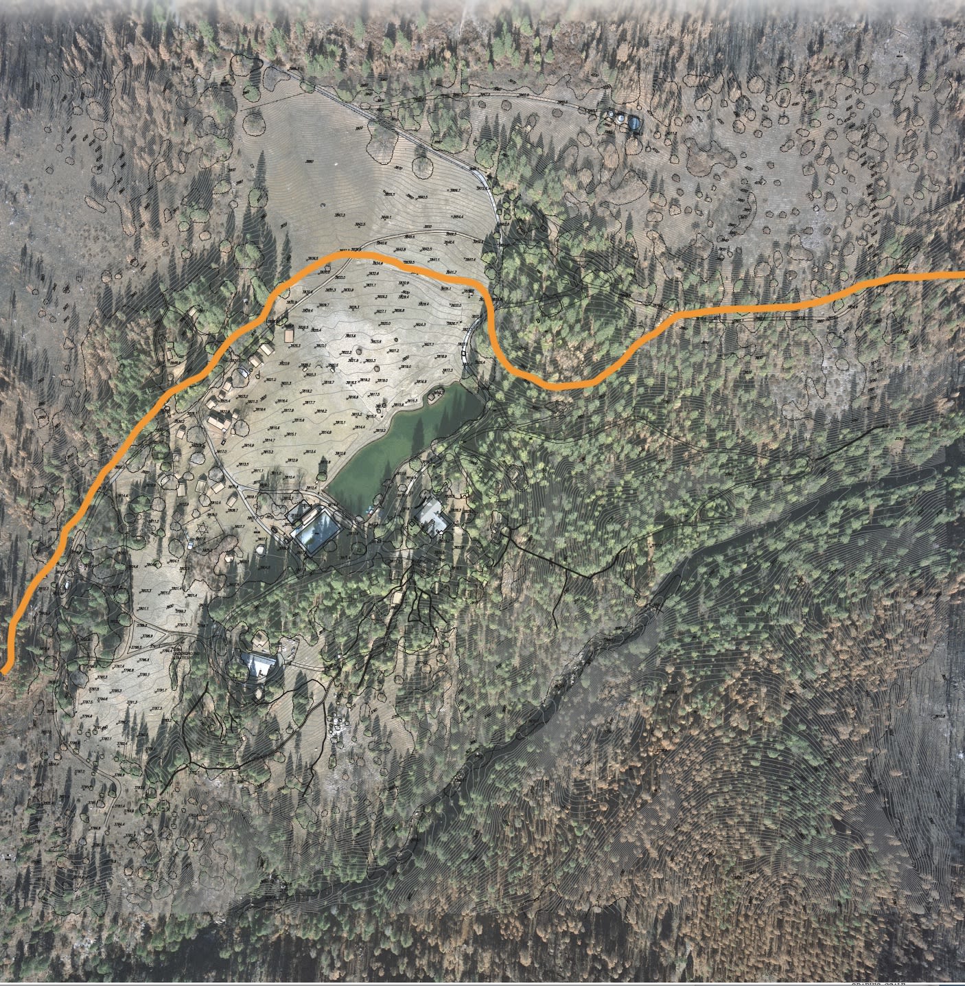
The orange line on this map shows the path of the Keystone Ditch through Camp property.
The orange line on this map shows the path of the Keystone Ditch through Camp property.
Generations of campers and counselors have crossed this landmark daily without realizing that the ditch has a name, or that it once carried water for gold mining.
The Keystone Ditch was part of a larger network of hand-dug and engineered channels built throughout Tuolumne County in the 1850s and 1860s. These ditches were designed to divert water from the Tuolumne River and its tributaries to mining sites miles away, providing the steady flow needed for hydraulic mining operations.

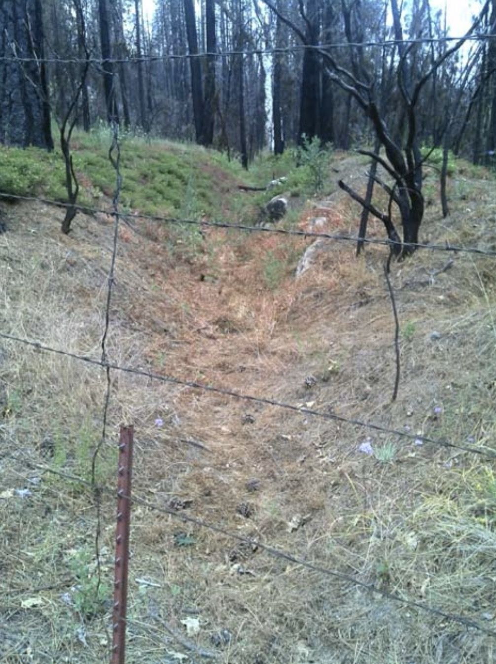
One section of the Keystone Ditch, barely recognizable as a human-made feature, that runs through Tawonga’s property
One section of the Keystone Ditch, barely recognizable as a human-made feature, that runs through Tawonga’s property

The Ranching Era
When the mining boom faded in the mid-1800s, the Sierra landscape entered a new phase. Former mining lands were gradually taken up by ranchers and homesteaders who used the newly opened meadows and logged hillsides for grazing cattle and sheep. Several families established possessory claims in the area around today’s Camp Tawonga, including the Screech brothers and Colwell Owen Drew — early settlers who became well-known figures in the Groveland and Hetch Hetchy region.

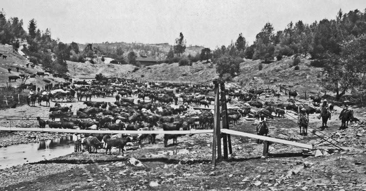

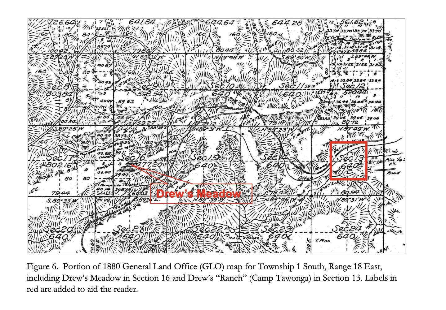

Over time, Drew emerged as the principal rancher associated with the land Tawonga now occupies. His holdings spread across several parcels between the Main and Middle Forks of the Tuolumne River, including what came to be known as Drew’s Meadow and Drew’s Ranch (which is now Camp Tawonga).
Although few physical traces of this ranching era remain at Tawonga today, the landscape still reflects it. The two large meadows on Camp property — likely created or expanded by logging and later maintained by grazing — are consistent with the kind of open pastureland ranchers relied on in the late 19th century.

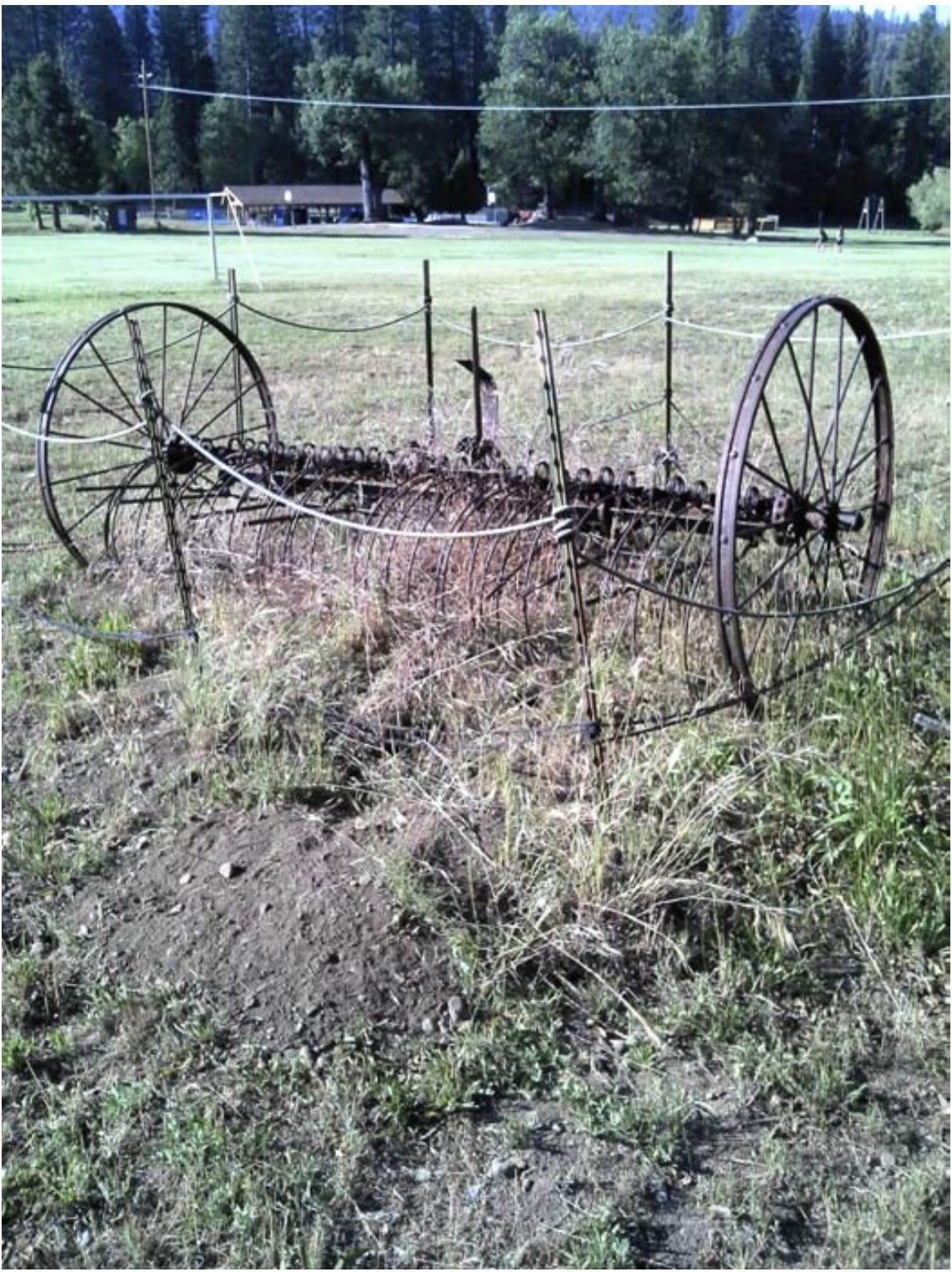
This hay rake, which sits on the sports field between two Ridge Side cabins, was likely used by cattle ranchers in the early decades of the 20th century.
This hay rake, which sits on the sports field between two Ridge Side cabins, was likely used by cattle ranchers in the early decades of the 20th century.
These meadows, along with faint traces of old roads and clearings, offer subtle reminders of the decades when livestock, rather than campers, moved through this part of the forest.
Power Companies and the Race for Hydroelectric Rights
As the mining era shifted toward electrification in the late 1800s, hydroelectric power became the next frontier in the Sierra. Dozens of small companies — many created by mining investors — began filing water rights on nearly every stream and fork of the Tuolumne River.

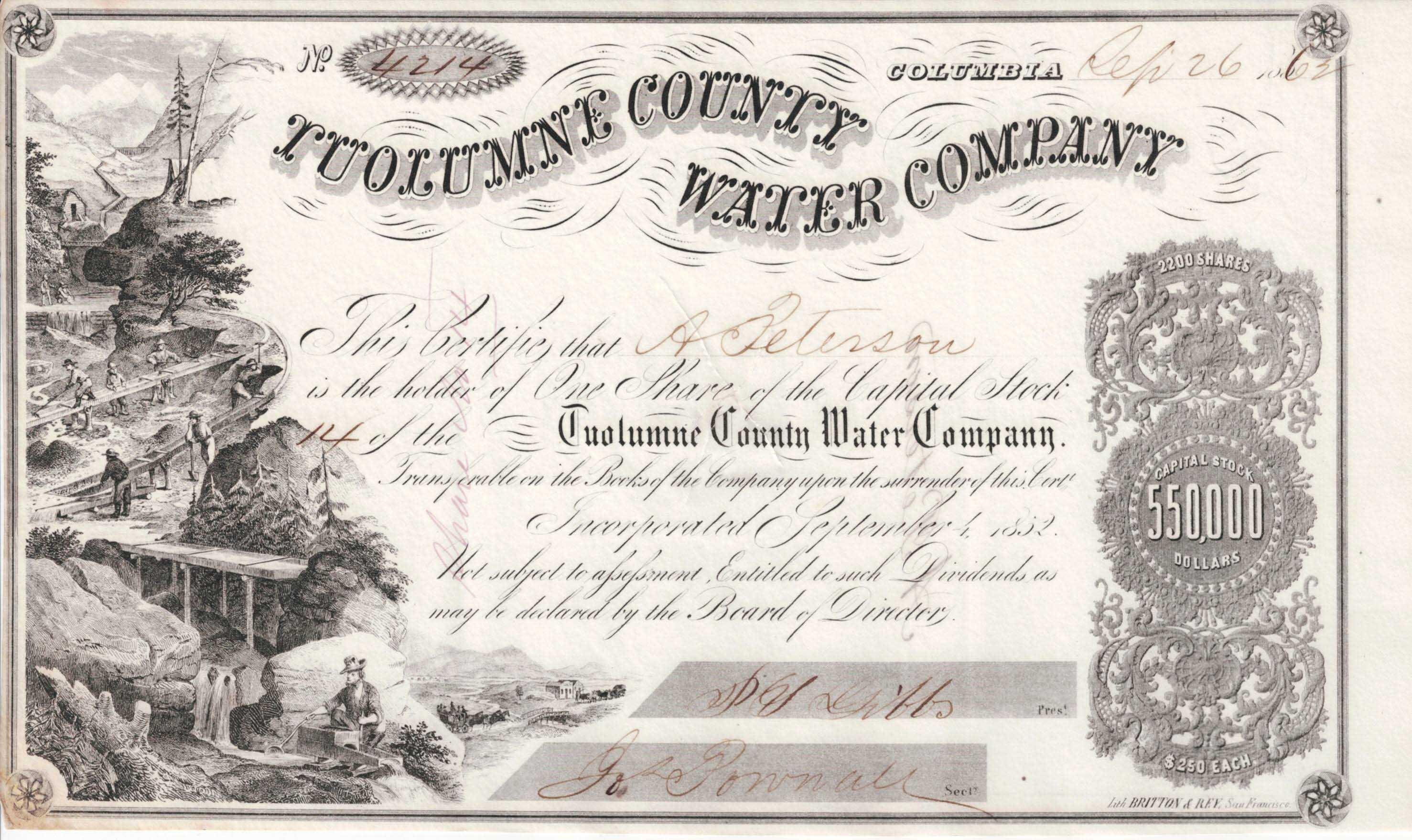
The Middle Fork, which runs through Tawonga's property, was no exception. At the turn of the 20th century, companies such as the Union Electric Company, the National Park Electric Power Company, and the Yosemite Power Company acquired parcels throughout the region, hoping to build powerhouses, diversion dams, and ditches that would supply electricity to mines and the growing cities of the Central Valley and Bay Area.
Most of these plans never materialized. Companies repeatedly bought and sold water rights, traded land, mortgaged claims, and shifted ownership among investors — but no hydroelectric facilities were ever constructed on the 160-acre parcel that would later become Camp Tawonga.
As San Francisco moved to secure control of the Tuolumne River for the Hetch Hetchy project, many of these early property rights were absorbed into the city’s system.

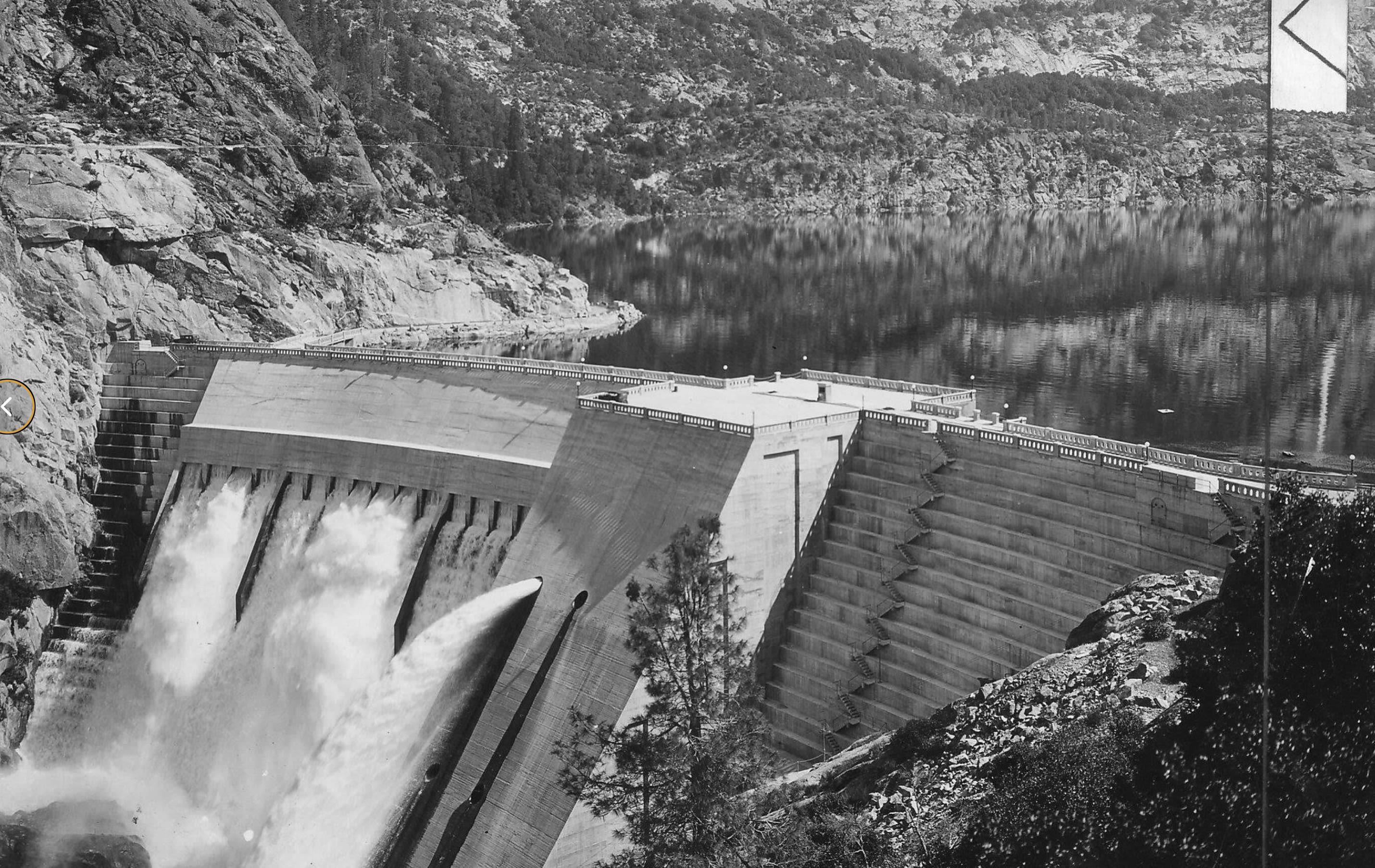
The O’Shaugnessy Dam, at the Hetch Hetchy Reservoir, completed by San Francisco in 1923
The O’Shaugnessy Dam, at the Hetch Hetchy Reservoir, completed by San Francisco in 1923
But the City and County of San Francisco did not purchase the Tawonga parcel. Instead, the property passed back into private hands. By the 1920s, it was owned by the Hamby family, who sold the land in 1952 to the Columbia Park Boys’ Club — setting the stage for today’s Camp Tawonga.
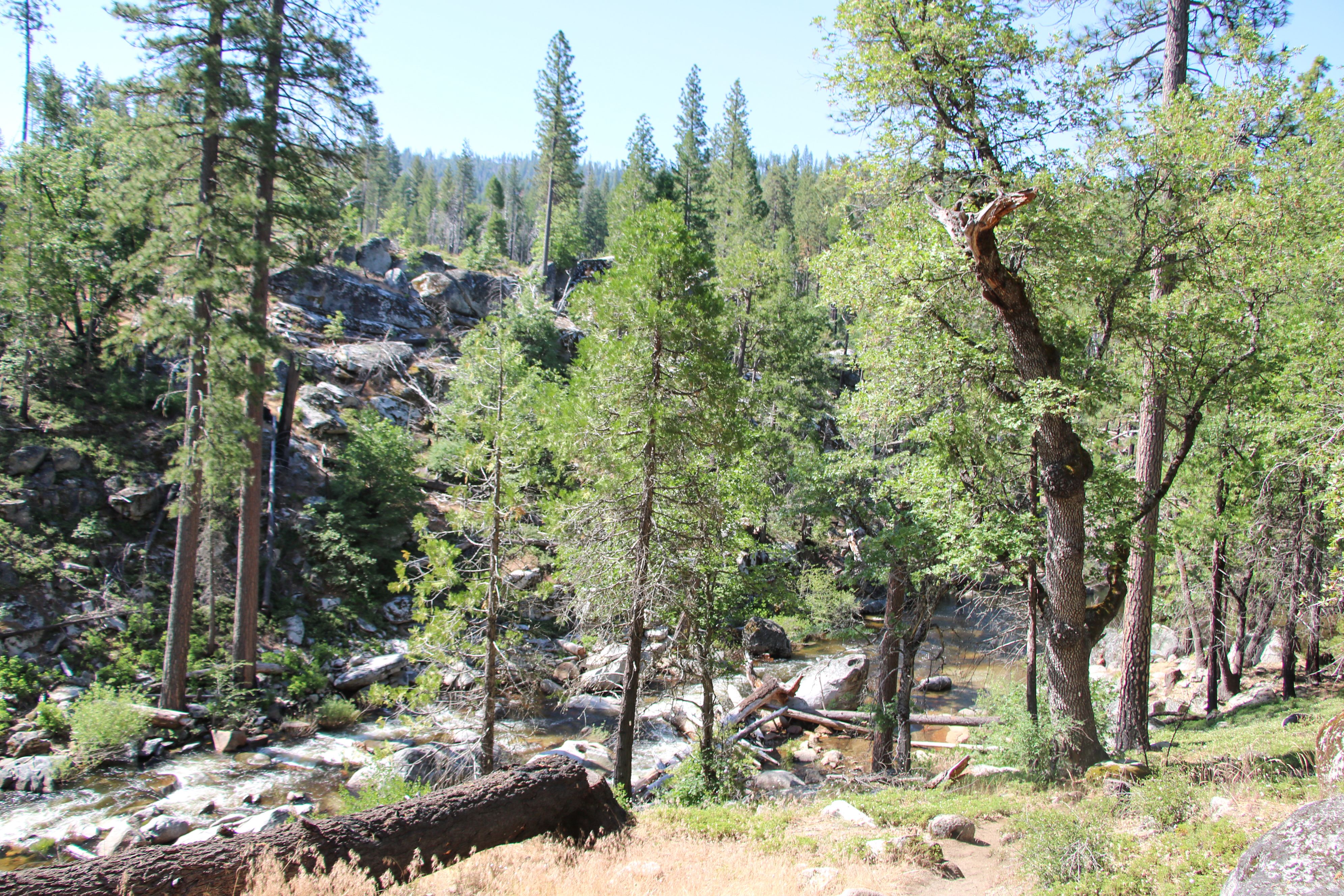
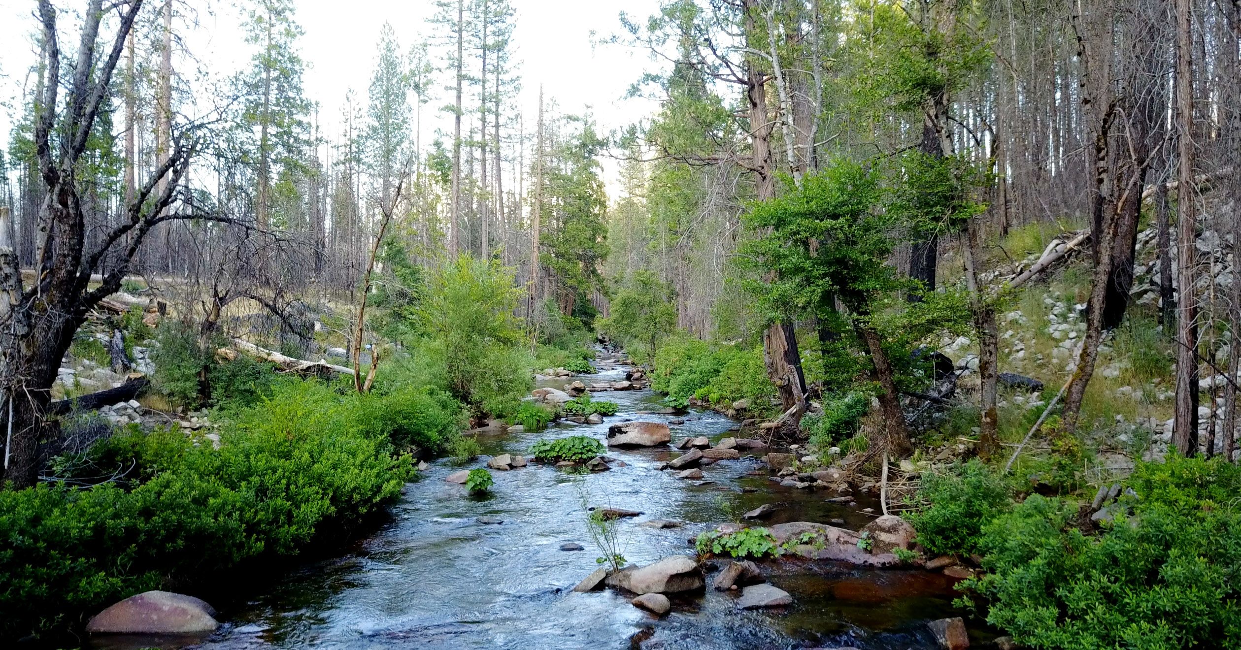
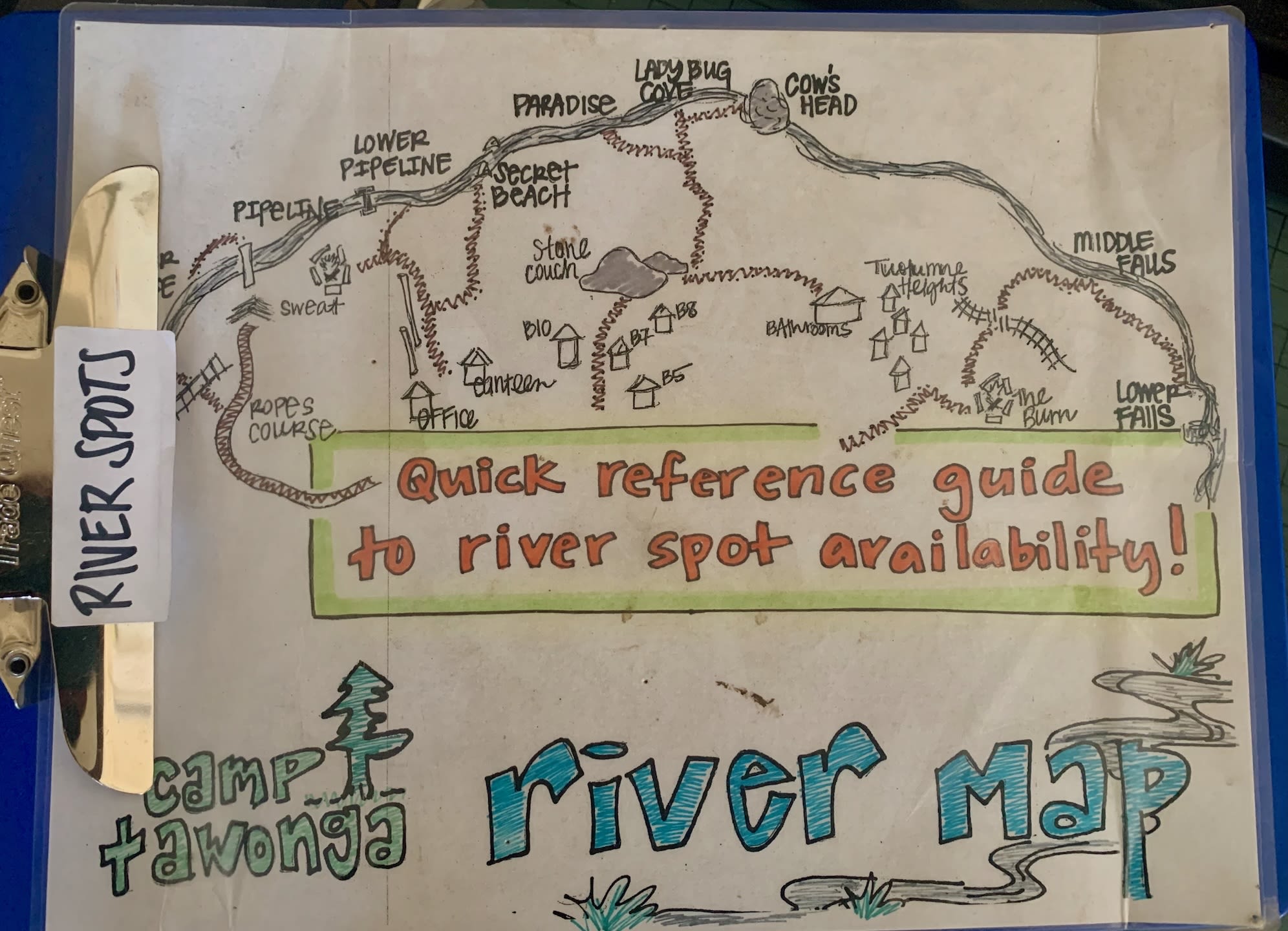
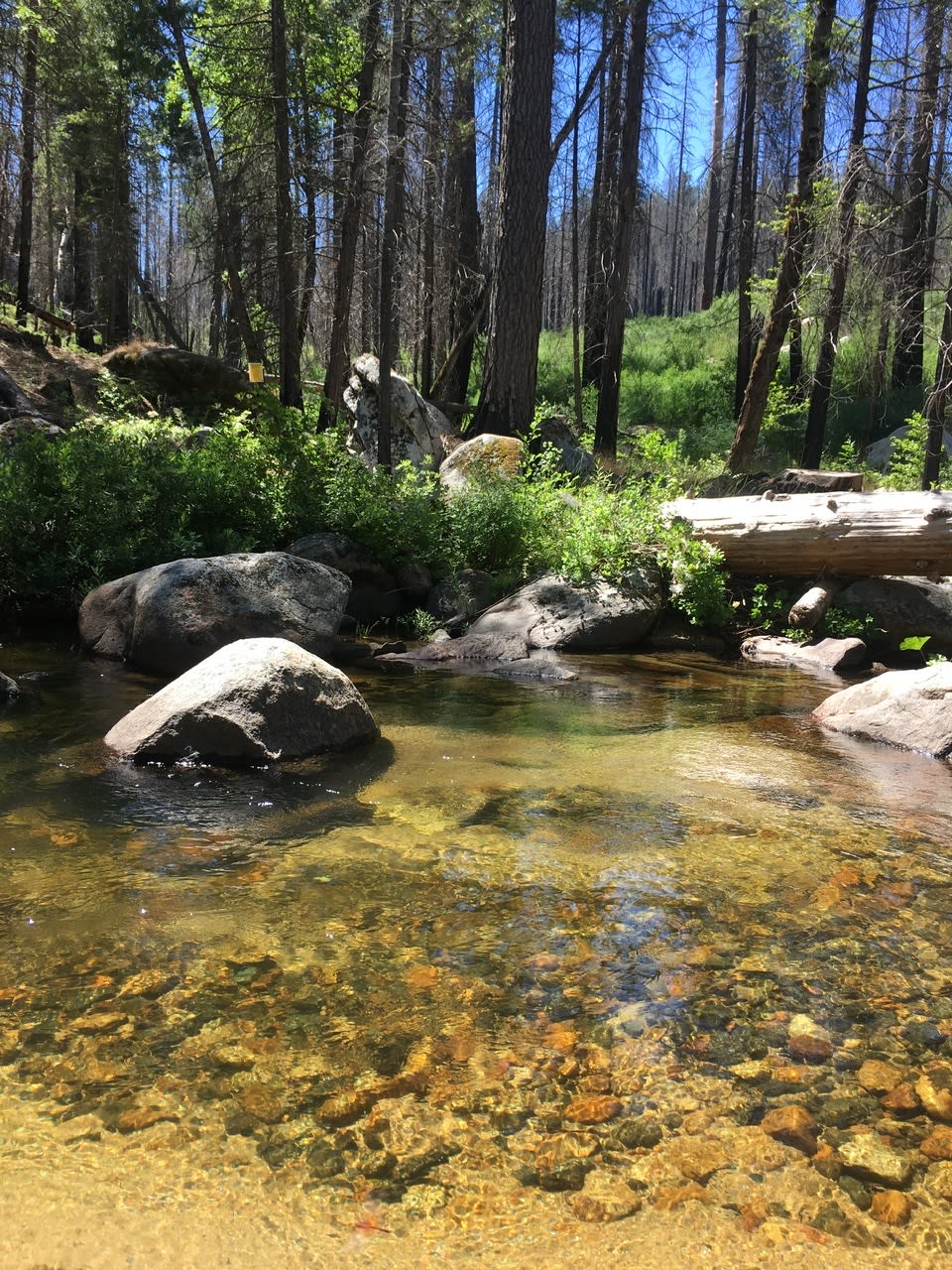
The Tuolumne River
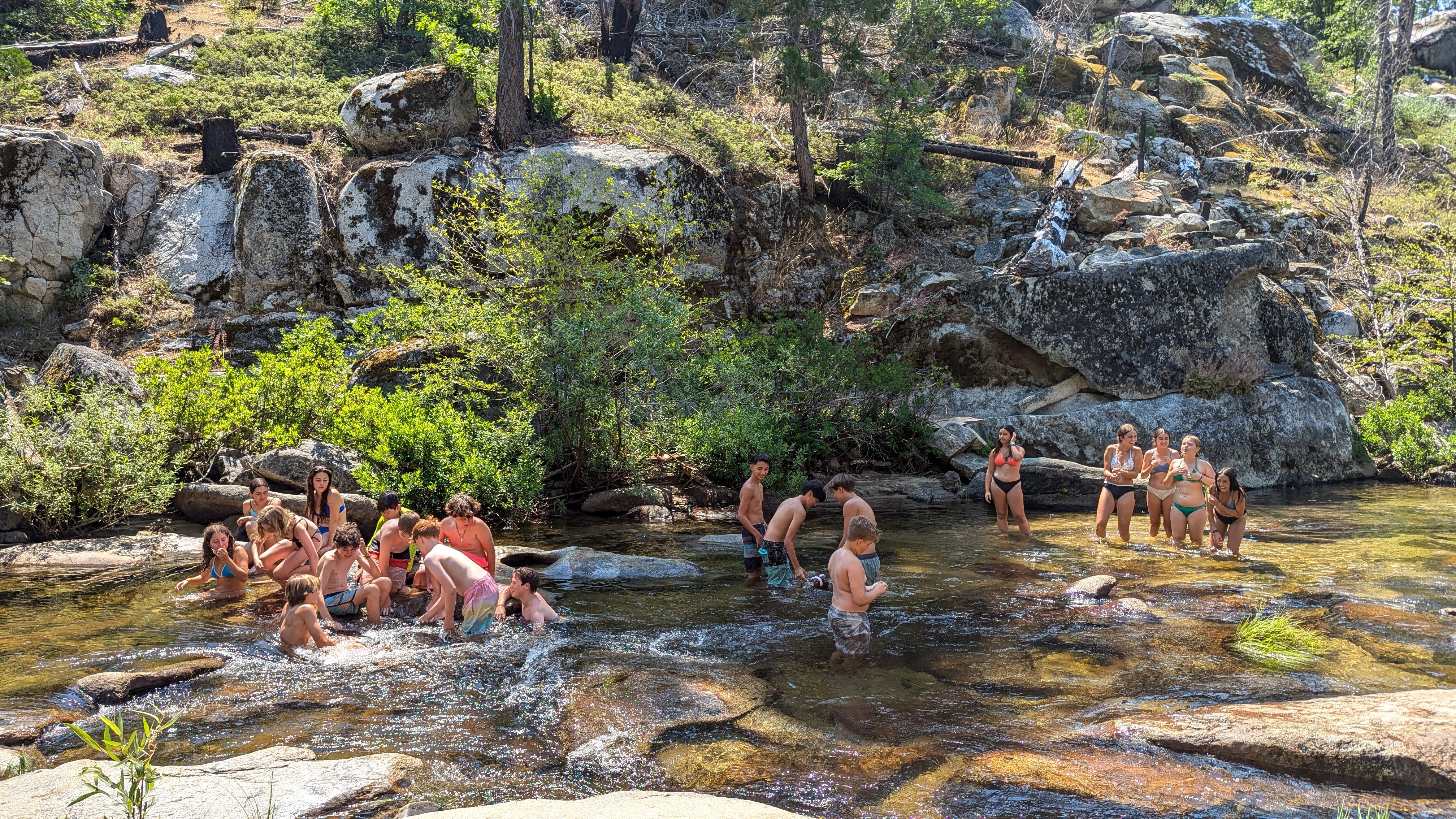
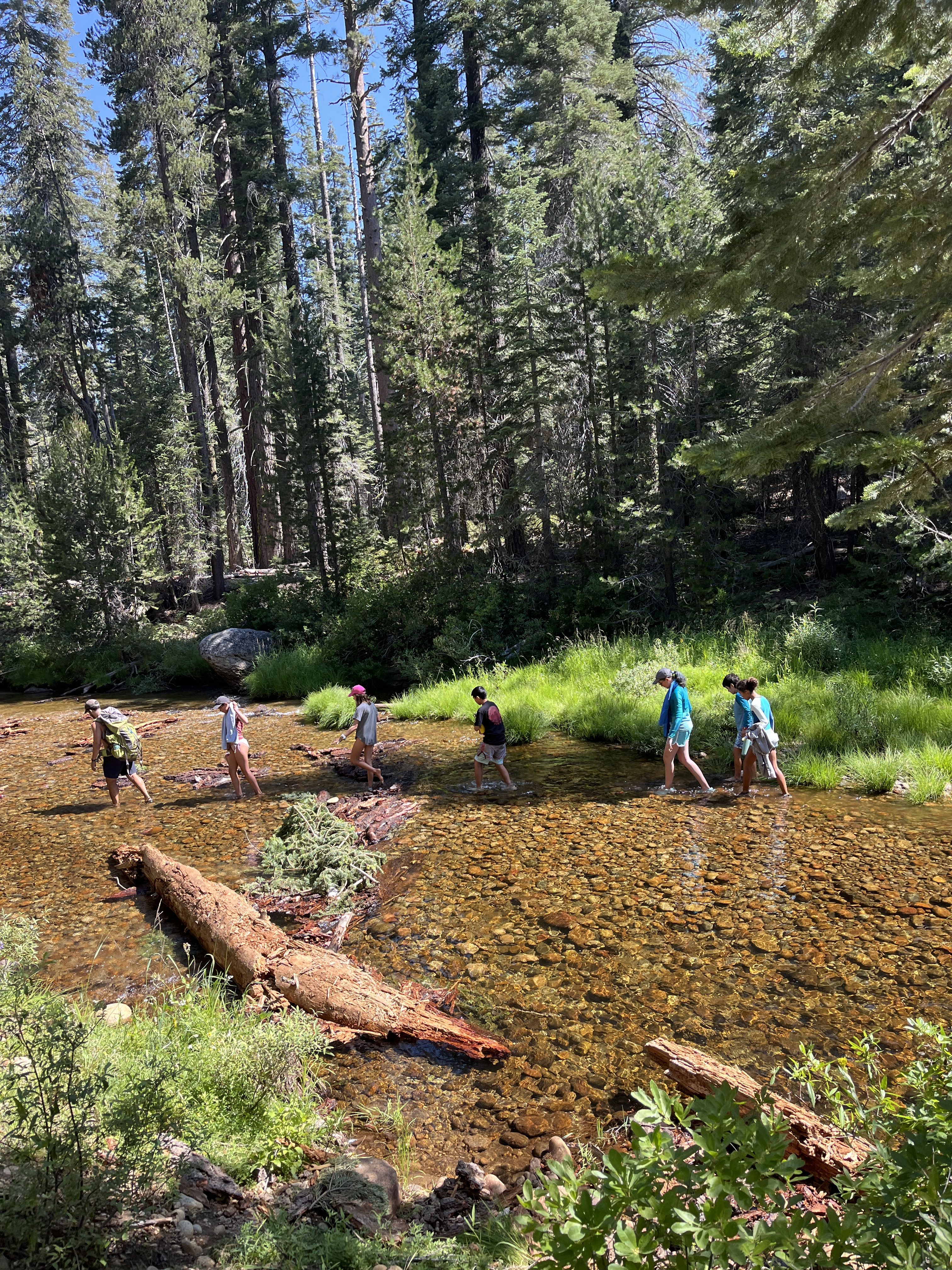
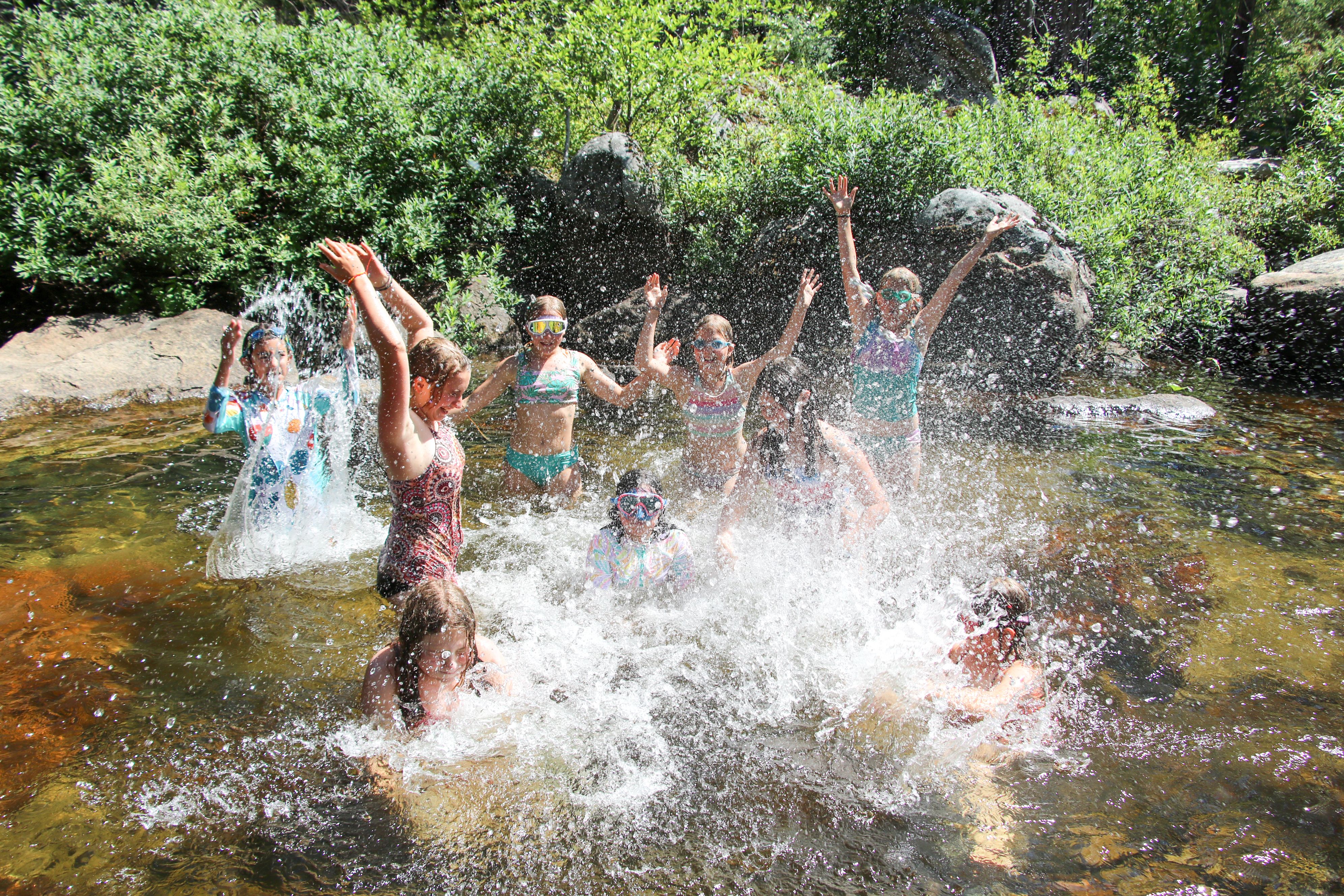
The Middle Fork of the Tuolumne River flows right through the middle of Camp Tawonga. Fed by snowmelt high in the Sierra, it brings cold, clear water to Camp each summer — a defining part of Tawonga’s landscape and traditions.


Our section of the Tuolumne River is part of a much larger, interconnected watershed.
The Tuolumne River begins in the high alpine headwaters east of Yosemite — around Lyell Canyon, Kuna Crest, and the high lake basins near Mount Dana and Mount Lyell.
From there, the river drops into Hetch Hetchy Valley, where it forms Hetch Hetchy Reservoir — created in 1923 with the completion of O’Shaughnessy Dam to supply drinking water and power to the rapidly growing city of San Francisco.
Below the dam, the river continues west and is joined by several major tributaries, including the Clavey and South Fork.
Our own Middle Fork is not pictured on this map. Like the North Fork and the South Fork, the Middle Fork is technically a tributary river of the larger Tuolumne.
Downriver, the Tuolumne slows as it reaches the foothills, eventually entering the Central Valley near Modesto.
Lake Don Pedro is known to generations of Tawonga campers as the large reservoir along the side of the road that runs between Highway 120 and the Priest Grade road that climbs up to Groveland.
From the road, the reservoir looks vast. So you may be surprised to learn that the section our buses drive past is just the northernmost section of an even larger reservoir.

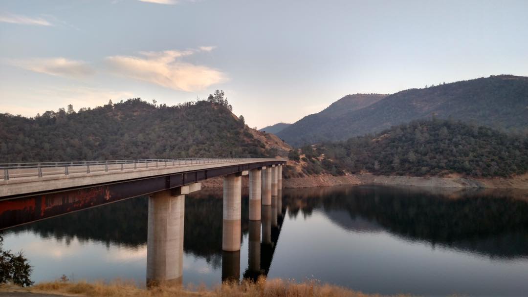
The Jacksonville Bridge, a section of Highway 120, over Lake Don Pedro
The Jacksonville Bridge, a section of Highway 120, over Lake Don Pedro


When Tawonga purchased the property from the Columbia Park Boys’ Club, it inherited a legal right to take a certain amount of water out of the river each year. These riparian rights allow Tawonga to pump water from the river into the lake.

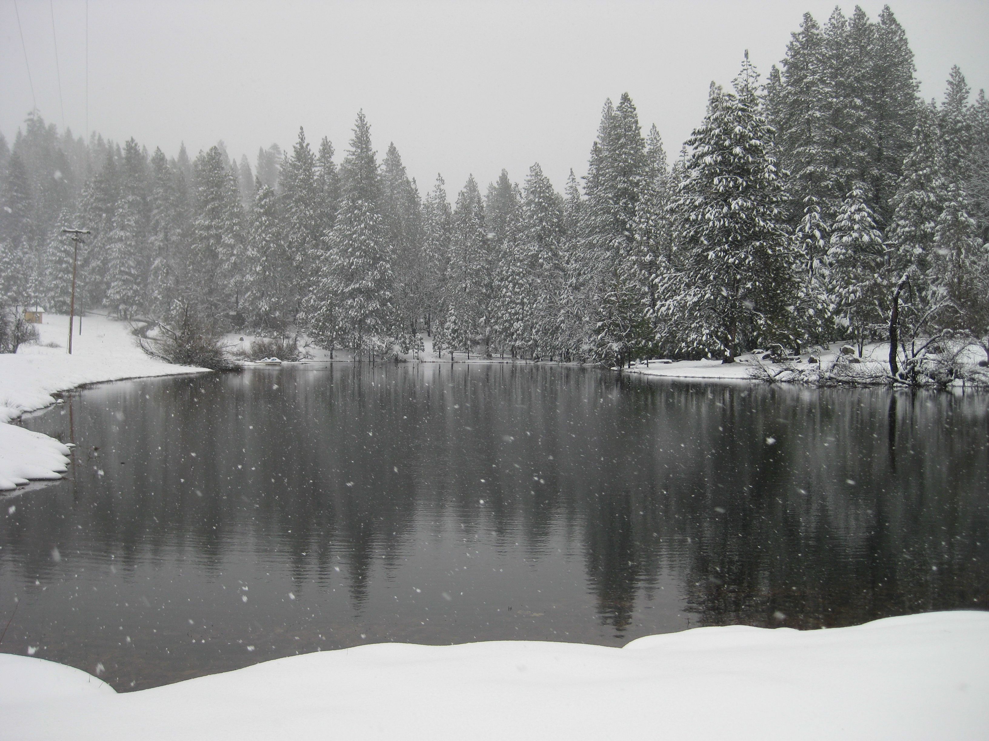
Camp Tawonga’s lake on a snowy day
Camp Tawonga’s lake on a snowy day
Tawonga’s drinking water does not come directly from the river. Our pristine water is pumped from aquifers deep under the ground.
But more than just providing water for the lake, the Tuolumne River is central to the Camp experience.
Generations of campers and staff have enjoyed and treasured the many swimming spots, beaches, and wading areas along the river.

Trees & Plants
Camp Tawonga sits at the meeting point of several Sierra landscapes. Meadows, oak woodlands, and mixed conifer forest come together here, shaped by elevation, water, soil, and fire.
Below are a few of the most recognizable and common plants found on Tawonga’s land.

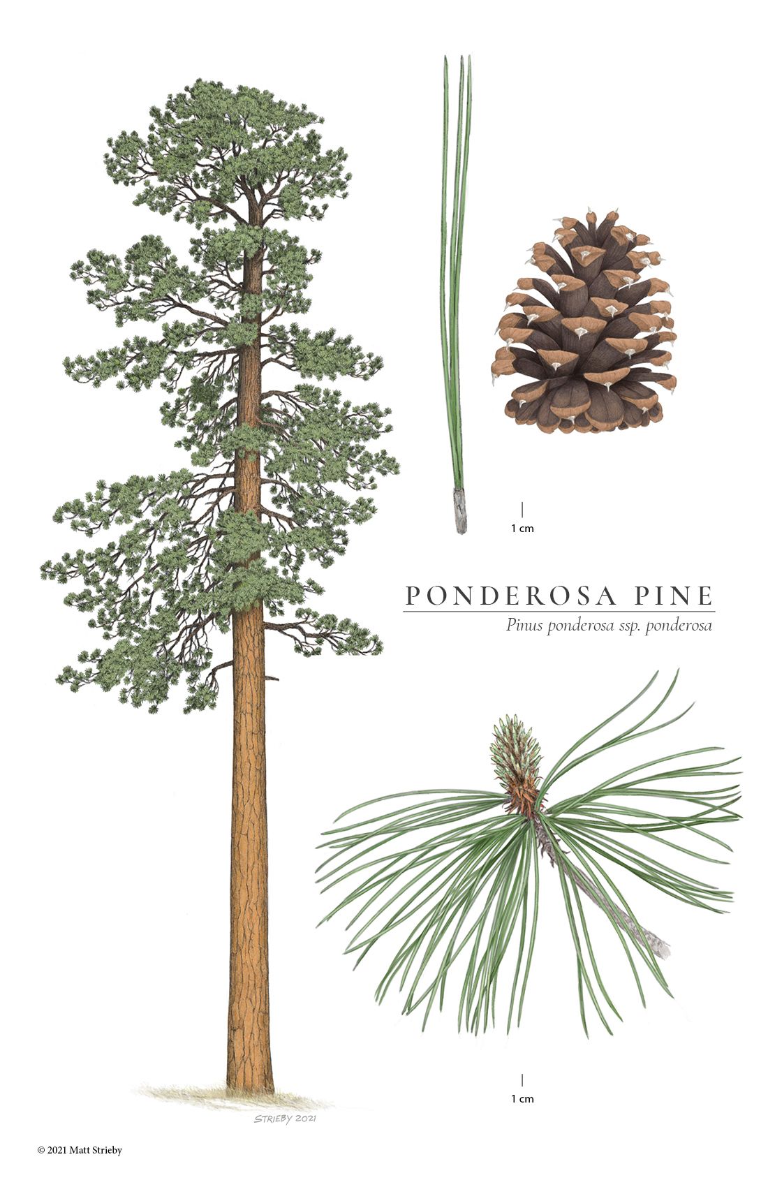
Ponderosa pine: one of Camp’s most common pines. Camp Tawonga sits within a mixed conifer forest, where Douglas fir, ponderosa pine, and Jeffrey pine grow together across the slopes and ridges.
Ponderosa pine: one of Camp’s most common pines. Camp Tawonga sits within a mixed conifer forest, where Douglas fir, ponderosa pine, and Jeffrey pine grow together across the slopes and ridges.
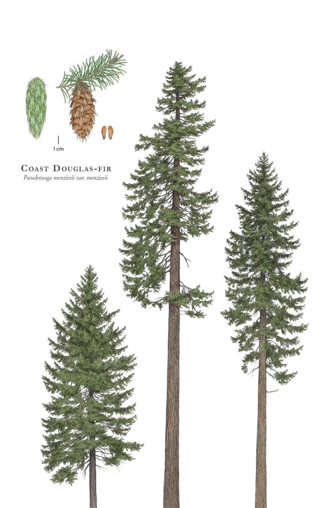
Douglas fir: another common pine tree at Camp. Our Buildings & Grounds crew frequently uses recycled wood from Douglas firs that have been removed for safety reasons. Many of Camp’s platforms, benches, and steps are made with wood from our own trees.
Douglas fir: another common pine tree at Camp. Our Buildings & Grounds crew frequently uses recycled wood from Douglas firs that have been removed for safety reasons. Many of Camp’s platforms, benches, and steps are made with wood from our own trees.

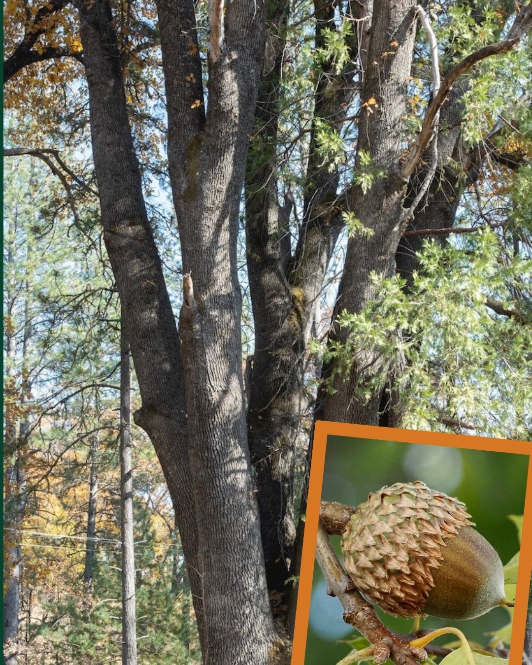
Black oak: these large trees, found throughout Camp, produce the acorns that were a stable of the Miwok diet.
Black oak: these large trees, found throughout Camp, produce the acorns that were a stable of the Miwok diet.

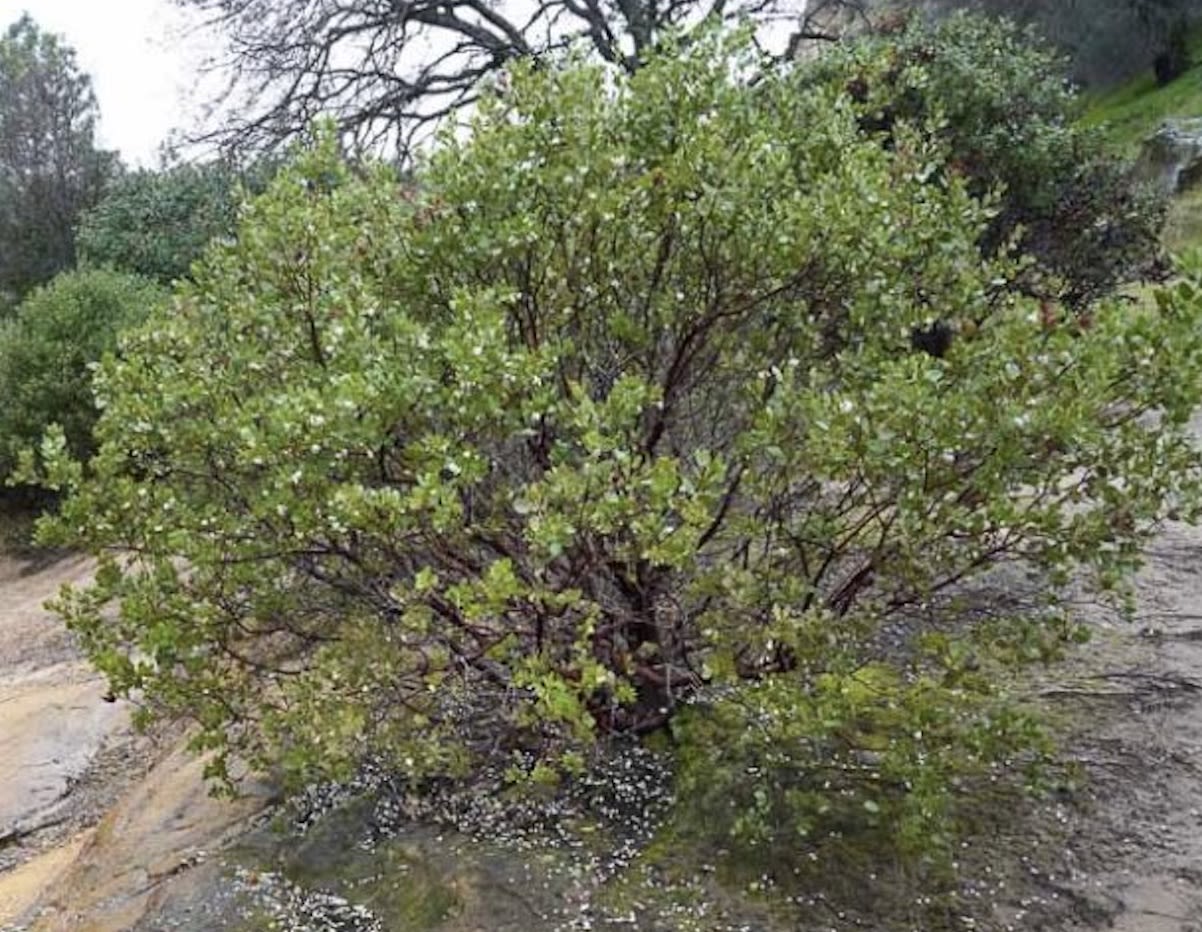
Manzanita, with its smooth red bark and tangled branches, is one of the most common shrubs at Camp. (The cluster of staff and guest housing on the Ridge Side of Camp is named after this native shrub.)
Manzanita, with its smooth red bark and tangled branches, is one of the most common shrubs at Camp. (The cluster of staff and guest housing on the Ridge Side of Camp is named after this native shrub.)

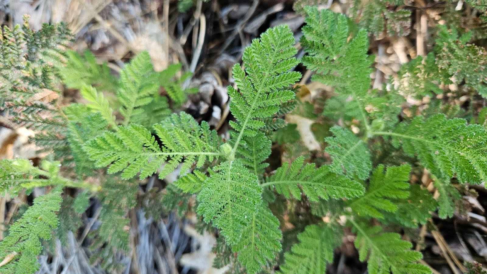
The distinctive scent of Camp comes largely from bearclover (also known as mountain misery), a low evergreen shrub that releases its sharp, resinous fragrance in the summer heat.
The distinctive scent of Camp comes largely from bearclover (also known as mountain misery), a low evergreen shrub that releases its sharp, resinous fragrance in the summer heat.

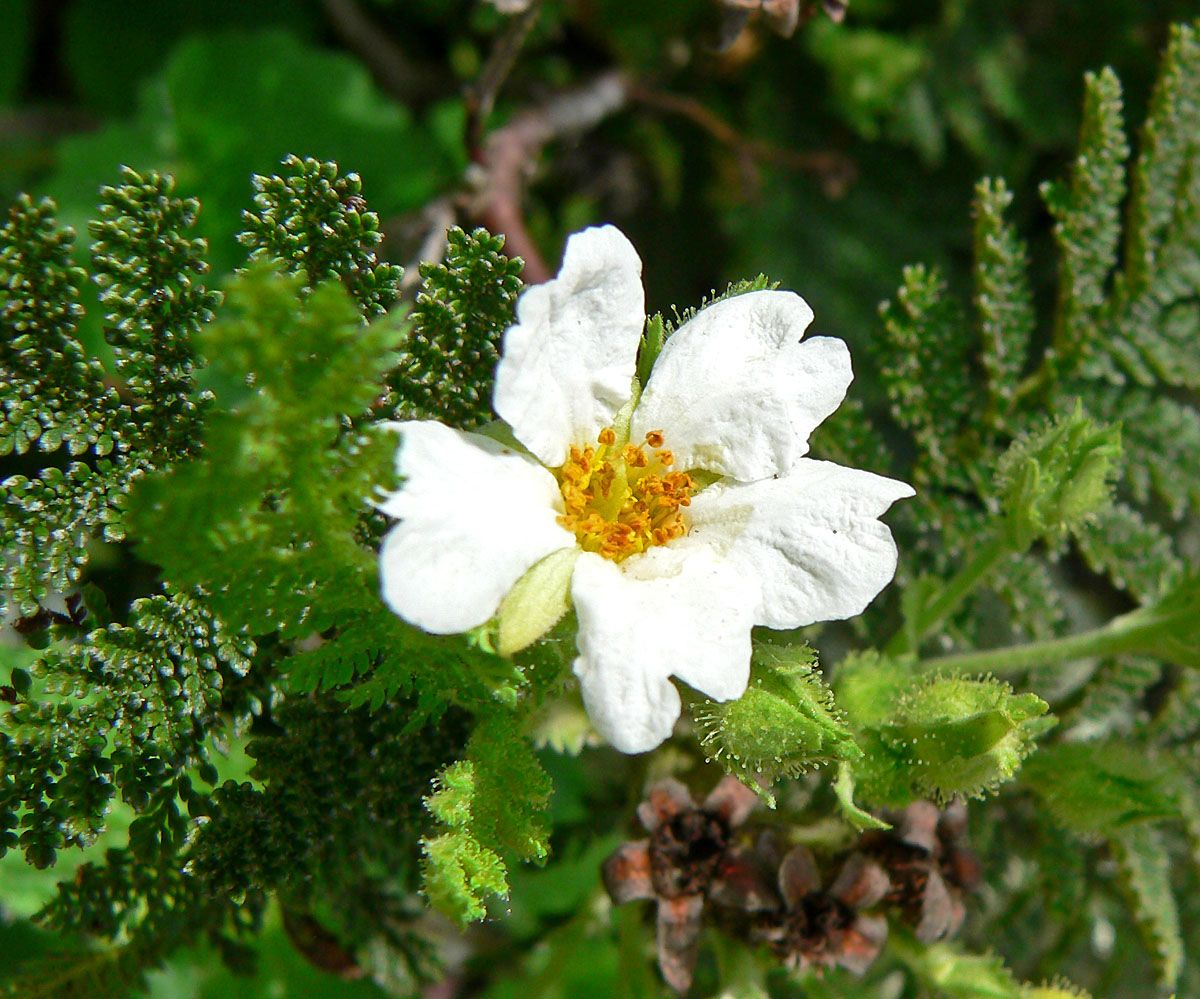
A second view of bearclover, showing its flower. The plant is a member of the rose family.
A second view of bearclover, showing its flower. The plant is a member of the rose family.

The land that holds Camp Tawonga today has been shaped by ice, water, people, and work over thousands of years.
What campers experience now is just one moment in that longer history. The river continues to run, the forest grows and changes, and traces of earlier histories remain visible.
Sometimes those traces are obvious; sometimes you notice them only if you know where to look.
The Story Continues . . .
We hope you’ve enjoyed this second chapter of Almost Heaven: A Visual History of Tawonga at 100
Future chapters will focus on a variety of topics and different aspects of Camp’s history, such as:
- Judaism and Jewish Programming
- The Camper Experience
- Camp Leadership from 1965-2025
- Lifelong Connections
- . . . and MORE!

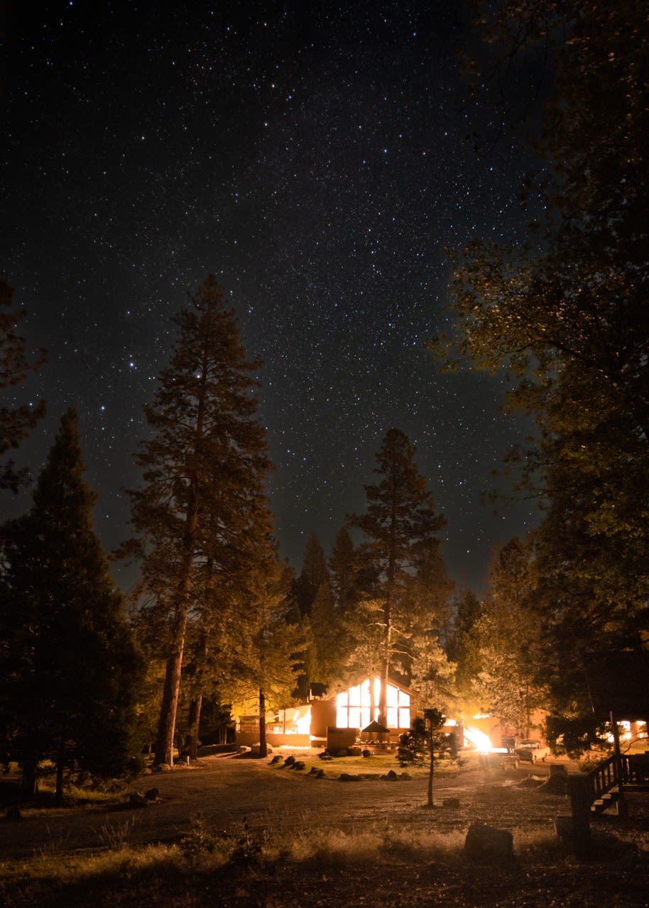
Chapter 3: Music, Songleading and Performance
Coming in early March 2026

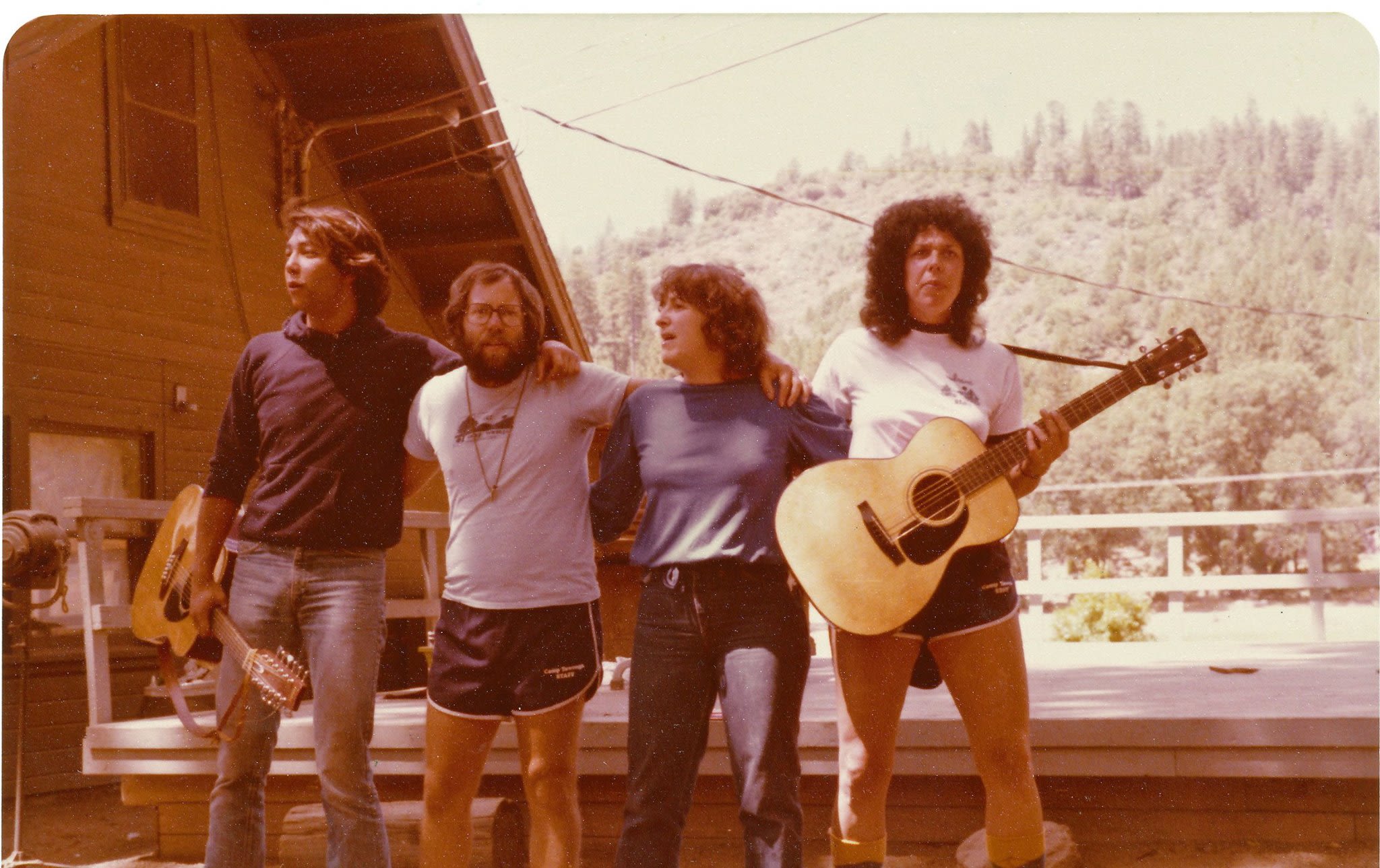
Learn more about history of music, song, and song leaders at Tawonga.
Chapter 4: The Dining Hall & Food
Coming in early April 2026

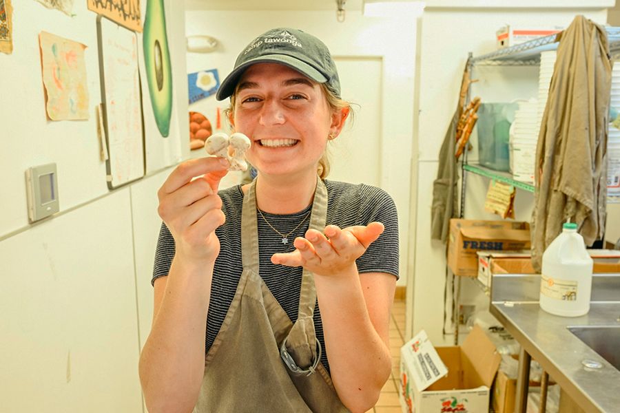
A deep dive into the history and traditions of our Dining Hall, Kitchen, and food at Tawonga.